


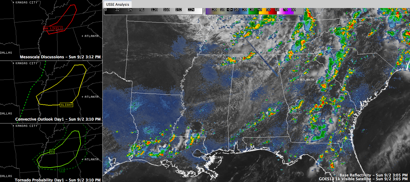
Showers and storms are forming as expected this afternoon over the Tennessee Valley of Northeast Mississippi and North Alabama. Fairly numerous showers and storms are expected to continue developing in this area. The storms will progress southeastward through an atmosphere left unstable from a Sunday of heating up the humidity.
A weather watch is likely soon, most likely a tornado watch, for Tennessee, northeastern Mississippi and extreme North Alabama.
Severe weather is a threat this afternoon and tonight across the northern third of Alabama with these storms thanks to some upper level energy rotating aorund the circulation of the low formerly known as Isaac. The wind shear associated with the band of energy will allow the storms to take on enough organization to be strong to severe and there could be enough spin for a few isolated, weak tornadoes.
Remember, if there happens to be a tornado or two, they will not be like our spring variety, but they still can cause damage. So, please make sure you have a reliable source for severe weather warnings through the night as these storms approach.
Afternoon readings will top out in the middle to upper 80s. Expect muggy lower and middle 70s tonight.



