


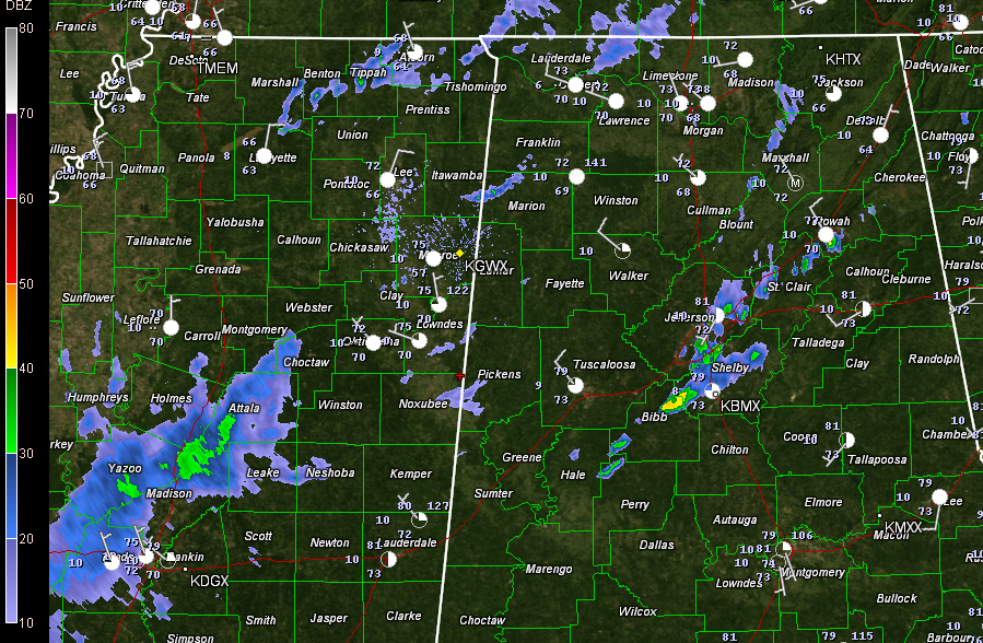
Quick radar update this morning as folks get up and out for Alabama and Auburn football this morning.
Our cold front extends from Limestone County down to Marion County down to Jackson Mississippi at this hour.
On radar, four main areas of precipitation to note:
1. From Huntsville down to the Birmingham area and points east: scattered showers over this area. Richard Viola picked up 0.14 inches as showers passed his location at Lake View near the Jefferson/Tuscaloosa County line. Folks in parts of the Birmingham area will see some of these showers for the next hour.
2. Another wave of light showers moving toward eastern Mississippi: It just rained lightly in Starkville, where Auburn and Mississippi State fans are gathering for an 11 o’clock game. This activity will reach Tuscaloosa between 10:45 and 11:00.
3. Another more extensive area of showers over South Central Mississippi. The northern extent of this area extends from the Jackson area north to about 30 miles west of Starkville. This band will bring brief showers to Davis Wade Stadium between 10:30 and 10:45. This activity could reach Tuscaloosa between 12 and 1. It is light and appears to be weakening, so just keep some rain gear handy for a light shower.
4. Post frontal showers: you can see showers back over northern Mississippi. Those are behind the front and indicate that we can’t rule out a spotty, quick hitting shower through the afternoon across Central Alabama and Northeast Mississippi. Again, keep the rain gear handy just in case.
Samford and Jax State will have great weather this evening.
We will be watching to see if more storms form this afternoon southeast of I-20 as the front works into an area that will have seen a little daytime heating.



