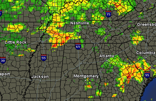
Things have calmed down over Alabama the last few hours, but we are expecting more showers and thunderstorms to develop during the overnight hours. A very warm, soupy air mass is in place. A lifting mechanism off to our northwest in the form of a trough and shortwaves will continue the thunderstorm threat during the overnight hours. Not expecting any severe weather, but some storms will be strong and will be producing frequent lightning and intense rain. Some gusty winds and hail could be possible as well.
Strong storms are currently over northern Mississippi and western Tennessee and are lifting towards the northeast. These storms are not expected to impact our counties, but we are watching for development down into central Mississippi and Arkansas the next few hours. That activity will be heading to the east and certainly could impact Central Alabama during the early morning hours.