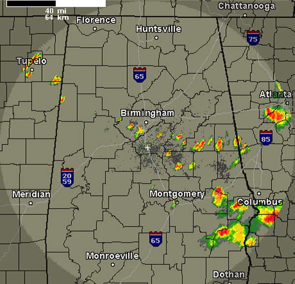
A quick look at the radar this evening shows a few additional showers and thunderstorms are developing across portions of Central Alabama. Thunderstorms have popped up across Randolph, Clay, Talladega, Coosa, Shelby, Jefferson and Lamar Counties. These storms are developing along a boundary and they will continue to drop south and are producing lightning and intense rain, even some small hail is being reported. With such an unstable air mass in place, it is not taking much to get these cells to develop. Storms are not expected to reach severe limits as instability is decreasing with the loss of daytime heating.

Published on: June 27, 2013 at 8:53 PM
Related Articles
October 24, 2026 at 6:36 AM
Pleasant Weekend on Tap
An upper-level ridge to our west and surface high pressure to the northeast will keep Alabama dry and slightly cooler this weekend. As we head into the week, the ridge will spread further into the state, warming us some and keeping rain chances at bay. Continue reading →
READ MORE
October 23, 2026 at 2:35 PM
Sunny Pleasant Days, Clear Cool Nights Through Next Week
ANOTHER SUNNY DAY: Temperatures are mostly in the 75-82 degree range across Alabama this afternoon with a sunny sky. Tonight will be clear with a low in the 40s and 50s. Alabama’s weather will stay rain-free through the weekend and … Continue reading →
READ MORE
