


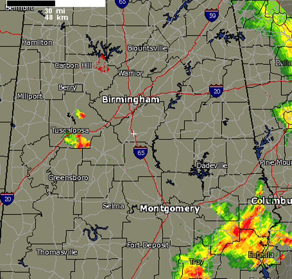
Most of Alabama saw dry conditions today. Earlier this afternoon, there were some strong storms that developed over portions of the East Alabama. Most of this activity has since dissipated. Still some strong storms to our southeast across Russell, Bullock and Barbour Counties.
Closer to us in Central Alabama, a few strong storms developed in extreme western Jefferson County, near Bull City and have dropped to the south across eastern Tuscaloosa County. A strong storm is approaching the city of Tuscaloosa and other storms have impacted areas along Interstate 20/59 and highways 216 and 11. As these storms continue to drop south, they will be impacting portions of Bibb and Hale Counties. Use caution if traveling highways 82 and 69.
These storms are producing hail, nickle and dime size have been reported in the Cottondale area. Gusty winds, torrential rain and tremendous amounts of lightning are occurring with these storms as well.
During the overnight hours, a few more storms may develop and some people will hear some rumbles of thunder overnight. Storms should remain below severe limits, but they could pulse up and reach severe limits briefly.



