


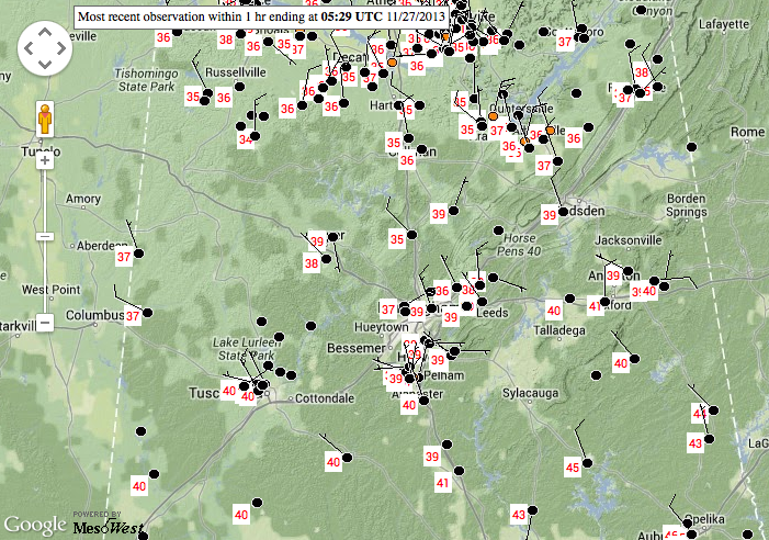
Temperatures continue to slowly fall across the area tonight.
Temperatures in the I-20 corridor are in the upper 30s. Along US-278, you will find middle 30s. It is a little cooler to the north of that.
The rain/snow level has dropped to around 2800 feet according to dual pol Doppler Radar.
There has been a steady stream of snowflake reports, but nothing significant enough to result in any accumulation.
The Weather Service is observing a few snowflakes at the Shelby County Airport in Calera. There are numerous other reports in many other counties.
Just got a report of snow flurries on Corridor X near Carbon Hill.
Ronald Hughes in Coker reports 38F with rain/sleet mix.
Expect the mix to gradually changeover to all snow, but it will have to hurry. The back edge of the precipitation shield is now near the Mississippi/Alabama border.
Temperatures will go below freezing after midnight. And standing water on roads, especially on bridges and overpasses will potentially freeze by morning, creating patches of black ice. So be careful and check road conditions before heading out in the morning.
Any places that pick up a burst of snow overnight could see a dusting to 1/4 inch of snow. Accumulations up to 1 inch on roofs and grassy areas could occur over northeastern Alabama north and east of Birmingham.



