


We are beginning to see the wintry precip wind down across central Alabama. Many locations have reported sleet and snow with some light accumulations on decks, cars, and grassy surface. No problems on the roads as temperatures remain above freezing.
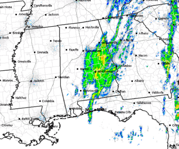
The rain/snow has ended west of Interstate 65 and no additional precip is expected for Birmingham, Cullman, Tuscaloosa and Gadsden. Most areas north of Interstate 20 in east Alabama are done with the precip too. Highways 231, 431, and 280 will be impacted for the next few hours until we will see this shield of rain/snow move east into Georgia.
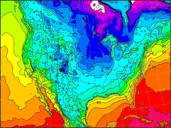
As the precip continues to taper off, temperatures will be dropping and winds increasing. The temperature forecast for 7AM shows most of north-central Alabama will be at of just below freezing. With the large amount of rain that has fallen over the last 24 hours, there are many areas that are seeing standing water. As temperatures drop below freezing, there could be a few slick spots and areas of black ice on some of the roadways in north-central Alabama. Exercise caution during your morning commute.



