


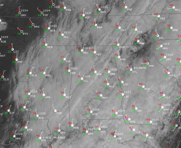
The rain has moved out of the state, but the cold air is moving in and will continue to spread south throughout the afternoon.
Temperatures are dropping today as a north wind brings in a much colder air mass into the state. This brisk north wind will persist through the afternoon. Temperatures across much of the state are in the 40s, and are only in the 30s in the Tennessee Valley. If the temperatures warm at your location today, it won’t be by much.
The clouds are hanging tough this midday, but we are beginning to see a few breaks in the clouds across the Tennessee Valley. The clouds are really beginning to thin out over portions of Missouri, Arkansas, Tennessee, and Kentucky, where the dry air is located. We are expecting the sun to be peeking out behind the clouds later this afternoon as the drier air invades our state as well. Some areas could be mostly sunny by late this afternoon.
The winds are expected to lessen overnight. With light winds, a clearing sky, and a colder air mass, we are all on our way to a cold night. By tomorrow morning, most location across Central Alabama will be in the 20s.
We will see full sunshine tomorrow, but it will remain cold. After starting the day in the 20s, most locations across Central Alabama will struggle to reach the 40s.



