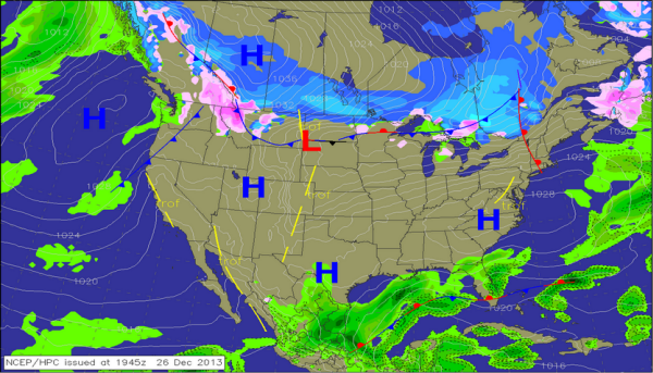
We have clear skies again tonight, which will allow for our overnight lows to head back to the 20s. We will all start the morning off cold, but we will once again see mostly sunny skies Friday, which will allow us to warm back up into the 50s. By late in the day tomorrow, you will notice an increase in clouds. These clouds will help keep our temperatures about 5-10 degrees warmer tomorrow night as they act like a blanket. Our winds will also shift out of the south, which will begin to bring in warmer and more moist air.
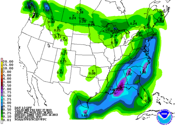
As we into the weekend, we are going to be watching an area of unsettled weather develop in the western Gulf of Mexico. Within this area, a low pressure will develop and will head northeast across the Gulf. It is expected to move onshore along the Florida Panhandle and track up through southern Georgia. This system will send a lot of moisture into the northern Gulf Coast.
With the ample moisture being drawn north from the Gulf of Mexico, we are expecting a soaking rain across portions of the Southeast. By Saturday afternoon is when we expect to see the rain impacting portions of Central Alabama. QPF for the state will vary depending on how the system tracks across the state, but as of now, the heavier totals should be to our south. Some locations will receive over two inches of rain this weekend, with a bulls-eye over Mobile and Baldwin counties. Across north-central Alabama, we expect totals to range from one half to an inch and a half of rain.