


An all new edition of the ABC 33/40 Weather Xtreme video is available in the player on the right sidebar of the blog. You can subscribe to the Weather Xtreme video on iTunes by clicking here.
HOT AFTERNOONS: We are forecasting a high of 90 degrees today, and if we reach that, it will be the warmest temperature so far in 2014, and the first time we have seen 90 degree heat since September 12 of last year. The sky will remain sunny.
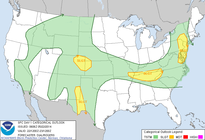
To the north, SPC has much of Tennessee in a “slight risk” of severe weather, but those storms will remain well to the north of here.
TOMORROW/SATURDAY: Not much change; mostly sunny both days with hot afternoons and a high around 90. A weak front could bring a brief shower to the northeast corner of Alabama, but even there the chance of a specific point getting rain is small.
SUNDAY/MONDAY: The afternoon high will remain near 90 degrees, and most communities will stay rain-free, although we might consider mentioning a slight risk of an afternoon shower as the ridge breaks down ever so slightly. But, no major change for our part of the state.
NEXT WEEK: Moisture levels rise by mid-week, and there should be an increase in the chance of scattered showers and thunderstorms by Wednesday and Thursday, with highs dropping back in the 80s. See the Weather Xtreme video for the maps, graphics, and details.
GULF COAST WEATHER: Looks great through Memorial Day from Panama City over to Gulf Shores with sunny days and fair nights. Highs on the immediate coast will be around 80, with 90 degree heat possible inland. The sea water temperature this morning at the Dauphin Island Sea Lab is 76 degrees.
WEATHER BRAINS: Don’t forget you can listen to our weekly 90 minute netcast anytime on the web, or on iTunes. This is the show all about weather featuring many familiar voices, including our meteorologists here at ABC 33/40.
CONNECT: You can find me on all of the major social networks…
Facebook
Twitter
Google Plus
Instagram
Look for the next Weather Xtreme video here by 4:00 this afternoon… enjoy the day…



