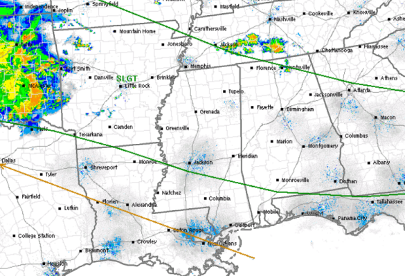
Nearly the entire state of Alabama has been outlined in a standard “slight risk” for severe weather today. Much like we saw yesterday, strong and severe storms are expected to impact many areas of the state later this afternoon and evening.
As of now, not much showing up in the way of thunderstorms across the Southeast. There are a few showers and storms ongoing across Tennessee, but these are not severe. Back to the west, we can see a MCS back across Oklahoma, that has been responsible for quite a few severe weather warnings this morning. This MCS will continue to track off towards the east-southeast throughout the day and will be crossing the Mississippi Valley and the Southeast.
Ahead of this feature, we are expecting showers and storms to develop that will tap into the instability in place and storms will once again be able to reach severe limits rapidly. Just like yesterday, the main threat from these storms will be damaging straight-line winds, some hail and of course very heavy rainfall and frequent lightning. With the helicity and shear values remaining rather low, tornadoes are not a threat. Storms should begin to wind down once the sun sets and daytime heating is lost.