


Coastal radars have the center of Edouard under surveillance tonight.
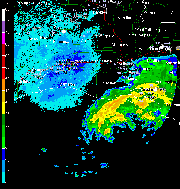
The last report from the recon plane showed a pressure of 999 mb. The storm doesn’t look any more organized on satellite. But the Doppler radars indicate that top winds have increased to 60 mph. Rigs off the Louisiana coast are reporting winds in the 45-55 mph range.
Convective bursts around the center are very efficient at bringing the upper level winds to the surface, so even if the system doesn’t strengthen significantly, it will still create some havoc.
The tropical storm is over water with high oceanic heat content and wind shear has relaxed. Edouard still could intensify another 10-20 mph overnight and is expected to be near hurricane strength by landfall.
At 10 p.m., the center of Edouard was 160 miles ESE of Galveston. The storm is moving rather erratically just north of west at 8 mph. It will make landfall in the Houston before noon on Tuesday.
Tides will run 2-4 feet in the onshore flow portion of the storm. Rains of 3-6 inches will be common in Southeast Texas, with an isolated ten inch amount not out of the question. The good news is that the extreme drough areas west of Houston may see 2-3 inches or more of rain. Tornadoes will be a problem, however.



