


Tropical storm Fay has top winds of 45 mph tonight even as it is being hindered by the high mountains of the island of Hispaniola. The latest position update places it 100 miles east of Port Au Prince, Haiti, moving west at 14 mph.
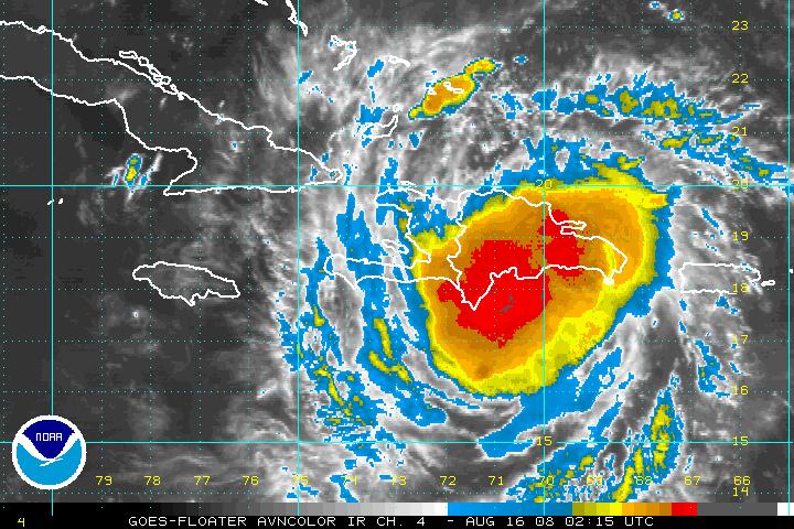
The center should emerge off the western coast of Haiti Saturday afternoon and encounter warm waters and light shear, allowing the storm to intensify.
An Air Force plane is scheduled to depart to investigate the storm around 11 p.mm CDT.
The official track forecast has been shifted only slightly westward, but as Dr. TIm Coleman indicates in his post below, the model guidance has definitely shifted west.
The forecast for Fay is very up in the air. But it does appear that we could have a significant hurricane in the Gulf of Mexico threatening the Central Gulf Coast by midweek.
All rcoastal esidents from the Upper Texas Coast to the West Coast of Florida have to monitor the latest information on Fay.



