VITALS…At 10 a.m. CDT…
LOCATION…19.0N…73.7W or 119 SE of Guantanamo Cuba
MOVEMENT…W-15
TOP WINDS…45 MPH
CENTRAL PRESSURE…1007 MB…ESTIMATED
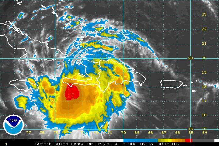
SUMMARY
Fay is emerging off the west coast of Haiti. Will be over water for several hours before reaching Cuba. Will spend day Sunday into Monday traversing the length of the island of Cuba. Will make northward turn late by Monday. Timing will determine what areas in the US are affected. Florida Keys look like strong candidate. Could go into southeastern Gulf and affect northern Gulf Coast. Could hug the west coast of Florida. Could go up the Florida Panhandle. Could emerge into Atlantic and affect Georgia and Carolinas. Interaction with land will determine eventual intensity.
WARNINGS
…Hurricane watch for central southern coast of Cuba
…Tropical storm warnings for southeastern Cuba
…Tropical storm warnings for southern Bahamas and Haitian Coast
…Tropical storm watch for Jamaica
…Tropical storm watch for Caymans
…Tropical storm watch for southern Bahamas
OFFICIAL FORECAST
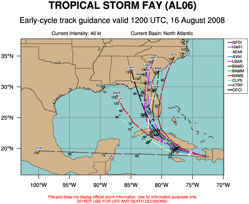
Spends day just offshore of southern Cuba, making a gradual bowling ball curve to the west northwest and northwest…becomes hurricane late Sunday night…emerges off Cuban coast Monday morning…reaches near Key West Monday night…to Fort Myers Tuesday morning…then inland over Florida Peninsula into southern Georgia by Thursday morning.
MODEL COMPARISONS…
EARLY LOOK AT 12z NAM…takes more easterly course…curving north just off the East Coast of Florida.
GFDL….carries it off the North Coast of Cuba as a strong tropical storm, over Keys as minimal huricane, into South Florida, back offshore and to the South Carolina coast before moving into southeastern North Carolina.
GFS…
To near Fort Myers…up the Peninsula and into Southeastern Goegria.
HWRF…
To between Fort Myers and Tampa and up the Peninsula into southeastern Georgia and South Carolina.
NOGAPS…
Carries it to near Mobile Bay by Wednesday night.
Canadian…turns it more northward over Cuba early Tuesday morning, taking it over the middle Florida Keys into South Florida Tuesday night, up the east coast of Florida and back over water. It then reintensfies and makes a hard left back into the Georgia Coast and South Georgia on Wednesday night.