


…FAY BETWEEN CUBA AND HAITI…
VITALS as of 4 p.m. CDT
LOCATION…Latitude 19.3N Longitude 75.2W or 100 miles south of Guantanamo Cuba
MOVEMENT…W 16
TOP WINDS…40 mph
CENTRAL PRESSURE…1006 mb
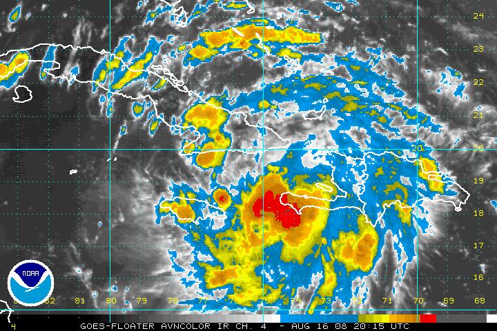
Two Air Force planes are investigating Tropical Storm Fay at this hour. They recently found a central pressure of 1006 mb.
WARNINGS
…Hurricane Watch…central Cuba…
…Tropical Storm Warning…SW Cuba…
…Tropical Storm Watch canceled for SE Bahamas, Turks and Caicos…
…Tropical Storm Warning for Haiti canceled except for SW Peninsula of Haiti…
…Tropical Storm Watch for Central Bahamas, Caymans and Jamaica…
A couple of camps on the model output…one carries in across the Florida Keys, into Southwest Florida, off the coast near Jacksonville and back inland over Georgia or South Carolina. The GFS and Canadian are in this corner. The HWRF basically agrees with this but takes the storm to a landfall near Tampa Bay as a strong tropical storm or minimal hurrcaine.
Another (GFDL) promotes a landfall in Southeast Florida and a trip up the East Coast of Florida before brushing the Carolinas…
The NOGAPS is the western outlyer, taking the storm to the Pensacola/Destin area and up into Alabama, but inexlicably doesn’t make it very strong. (I have to say that would probably be a good result for us with some good rains and little wind or surge damage along the coast.)
The new NAM is out to 60 hours and takes it south of Fort Myers and across South Florida.
The best model consensus right now is across Central Cuba to just west of Key West to between Tampa and Fort Myers and then on to the NNE. Alabama stays on the generally dry western side of the storm.
OFFICIAL TRACK
The official track is a little faster and a little further east. The biggest impact will be to the Florida Peninsula. 5 pm Monday near Key West…2 pm Tuesday near Tampa…2pm Wednesday near Cross City Florida and 2 pm Thursday near Augusta GA.
INTENSITY
Low wind shear in the storm’s path and a good anticyclone above it for outflow, so nothing to impede its development excelt land. The storm will be going over very high oceanic heat content and will become a hurricane before it crosses Cuba. The eventual intensity depends on land interaction effects. When it gets to South Florida, it probably will have top winds of 85-95 mph. It could be even stronger.



