


I have a big pile of e-mail questions from folks this morning asking about the specific impact of Fay on the Alabama Gulf Coast. Here is the 00Z model set:
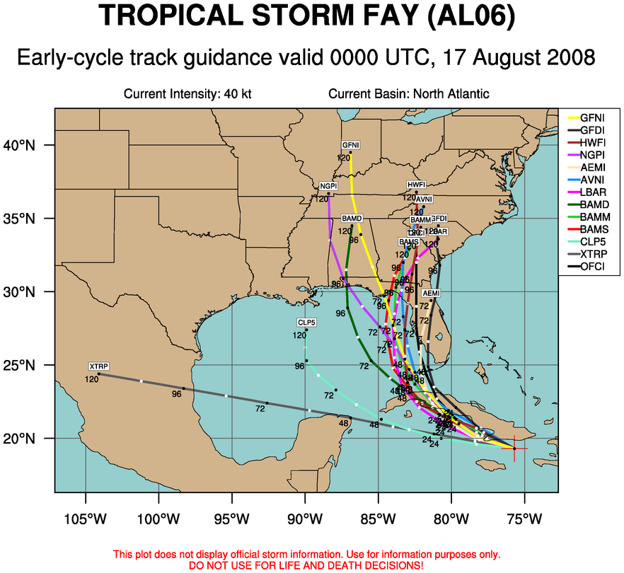
You can see the general idea is that Fay moves up into Florida, somewhere from Tampa Bay north to the Big Bend, and then north-northeast into Georgia and South Carolina. The NOGAPS is the only model that hints at a problem for Alabama, and is an outlier and rejected at this time.
If this solution is correct, there will be no direct problems along the Alabama coast other that rough surf (the same goes for Pensacola and Destin). The most serious impact of Fay will be along and east of the center, and most likely the greatest risk will be from flooding since the system won’t have much time to intensify over the Gulf. Our readers over East Georgia and the Carolinas could be dealing with a significant flood threat, which I think will be the main issue with this one.
I do believe it will become a hurricane, but most likely it will be a category one. We can be thankful this storm has been on a perfect track to keep it from becoming a really dangerous hurricane due to constant interaction with land.
Of course, this could change, but confidence is growing in this scenario. Brian will be along shortly with another Weather Xtreme video, and Bill and J.B. will have updates through the day.



