


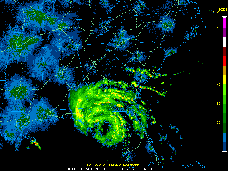
…Tropical Storm Fay moved back over Apalachee Bay shortly before 6 p.m. tonight. It is moving back inland again, for the fourth time, near the town of Sopchoppy in Wakulla County. It is on a westerly course at 8 mph.
…It will pass across southern Gulf and Franklin Counties, passing offshore again near Panama City around 7 a.m.
…The new NHC is pushed a little further south. It should remain over water until a fifth US landfall near Orange Beach tomorrow night.
…Winds have increased slightly to 50 mph…
…Fay should maintain tropical storm intensity until Sunday night, when it should be north of Lake Ponchartrain.
…On Monday, it will curve up into Southwest Mississippi, still as a tropical depression. By Tuesday, it should be coming back up I-59 over Alabama.
…Tropical storms warnings now extend west to the Mississippi/Alabama border.
…A tropical storm watch has been posted as far west as the Mouth of the Mississippi River…not including the City of New Orleans.
…Northward extent of rain at this hour…the outer rainband of Fay extends across Coffee…Pike…Bullock and Russell counties in Southeast Alabama. That is about 95 miles SE of Birmingham.
…A lake wind advisory here overnight…a wind advisory is posted on Saturday for winds averaging some 15-25 mph with higher gusts…
OBSERVATIONS
Panama City…Rain…73F/73F…wind NNW 23 G 35
Apalachicola…Rain…75F/72F…NNW 20 G 30…peak gust 34
Tallahassee…Rain…75F/72F…NE 20 G 38…peak gust 33
Dothan…Rain…73F/70F…NNE 20 G 32
Destin…Cloudy…81F/68F…N 18 G 25



