


The center of Tropical Storm Fay is once again reaching land…this time passing over Dog Island east of Apalachicola, and heading over the town of Carrabelle, Florida.
That’s four U.S. landfalls, but who’s counting, right?
Impressive looking storm…for what is has been through.
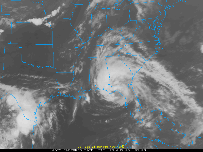
It has had spectacular outflow this afternoon and evening, but that may be weakening a bit now.
Radar estimates indicate seven plus inches of rain over areas south and southeast of Tallahassee tonight.
Top winds are still 50 mph.
There is no Air Force reconnaissance in the storm or enroute right now. A flight is scheduled for later this morning.
No significant wind reports at this hour. No major flooding yet.
Fay appears to me to be nearly stationary again. This will be a temporary pause in her westward trek. It will cross southern Franklin and Gulf Counties and emerge into the Gulf again in the morning. It may take a track even a little further to the south overthe Gulf…and that means the system will maintain its strength or even intensify a bit.
Tropical storm warnings are in effect all the way to the Mississippi/Alabama border.
SPOT REPORTS
Panama City…rain…75F/73F…N 22 G 37
Apalachicola…rain…75F/72F…NW 17 G 24
Talahassee…rain…76F/72F…ENE 21 G 30
CLOSER TO HOME
Birmingham…cloudy…79F/64F…wind NE 6 G 16
Rain had edged into Montgomery County now.
We will see increasing showers duiring the day on Saturday with more widespread rain likely Saturday night. Winds will be out of the ENE at 15-25, prompting a wind advisory from the National Weather Service.
Gonna leave it with you for a couple of hours to rest for a bit…talk amongst yourselves…the subject is: tropical storms…nature’s heat pumps…



