


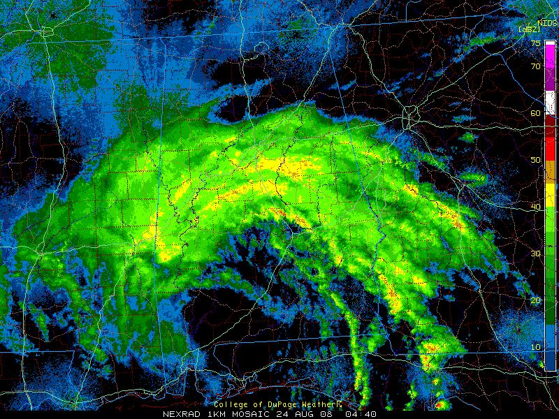
The center of Tropical Depression Fay is south of Grove Hill in Southwest Alabama tonight. It is moving WNW. It will be in Mississippi in a few hours.
The future course of Fay is uncertain. The uncertainty lies in when the steering currents will collapse, causing the remnant low to stall or at least meander, and how far west it will get before that happens.
An 80 mile wide curved band of moderate to heavy rain with some gusty winds bisects the state tonight from Choctaw, Sumter and Greene Counties through Tuscaloosa, Hale and Perry Counties to Jefferson/St. Clair/Shelby/Chilton Counties on east and southeast to the Georgia border.
Winds in the line are fairly strong…
Tuscaloosa NNE 18 G 27
Calera NNE 10 G 21
Alexander City E 13 G 24
Maxwell AFB E 24 G 32
The inflow into the huge feeder band does seem to be shutting down. The flow of precipitation off the Gulf over the eastern Panhandle is thinning now. The rain band over Alabama will eventually start to taper off.
With the remnant low to our west, more rain will form on Sunday over parts of Alabama. It is difficult to predict where the heaviest rain will fall, but the potential for excessive rainfall is high for the next 3-4 days.



