


A band of very heavy rain, associated with what is now Tropical Depression Fay, has been falling over much of south-central Alabama over the past few hours. The heaviest rain and strongest winds have been south of Clanton so far. Here is the latest radar-estimated rainfall since 3 am, from the radar between MGM and AUB.
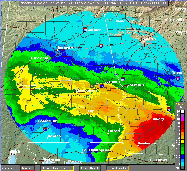
A few observed amounts include: BHM 0.26, TCL 1.02, Calera 1.24, Jemison 2.84, MGM 3.56, Trop 5.50″.
The rain band is moving northward, and the BHM metro area is due for plenty of rain overnight, with additional amounts of 1-3″ by 8 am Sunday.
What then? Some of the models slow Fay down, but eventually it should turn NE and head out of the SE US. Maybe by monday, or maybe not until later in the week. We have lots of moisture in place, and with the circulation nearby, showers and storms are likely at least through Tuesday. Total rain amounts in the BHM area of 3-6″ are the best guess, with some places getting over 10″. This could cause some serious flooding issues.
Here is the total 7-day precipitation map (ending yesterday afternoon), from the NWS SE River Forecast Center.
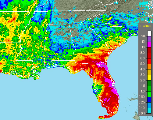
Large area of Florida got over 10″, with some spots along the east coast over 20″.



