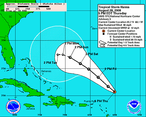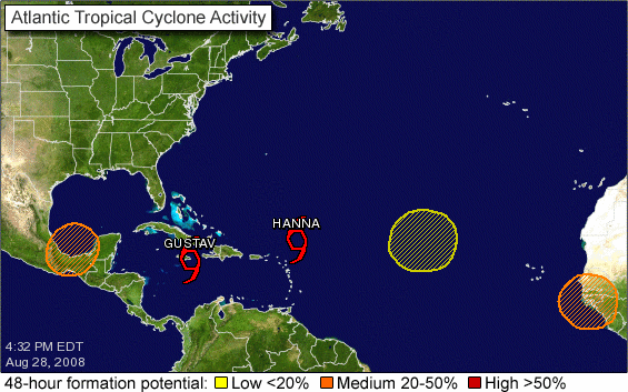
Wow. We are nearing the peak of the Atlantic hurricane season, and you can tell it. 5 areas of concern. Obviously, the big deal right now is Gustav, since it has the potential to affect the Gulf Coast as a significant hurricane early next week. See J.B.’s post below for the official information, and Brian’s “worst-case scenario” blog from the European model below. The latest NHC track carries Gustav to a landfall along the central Louisiana Coast on Tuesday. However, the storm is still has to interact with Jamaica and Cuba before it reaches the Gulf this weekend. The models are in fairly good agreement on the general curving of the storm to the NW, but consider that a track angle error from Cuba to the U.S. Coast of only 10 degrees makes a huge difference in where it makes landfall. This from NHC: “IN FACT…TAKING INTO ACCOUNT THE UNCERTAINTIES IN TRACK…INTENSITY…AND SIZE FORECASTS…THE CHANCES OF HURRICANE-FORCE WINDS WITHIN THE NEXT FIVE DAYS ARE ESSENTIALLY THE SAME AT EACH INDIVIDUAL LOCATION FROM THE FLORIDA PANHANDLE COAST WESTWARD THROUGH THE ENTIRE COASTLINE
OF LOUISIANA.”
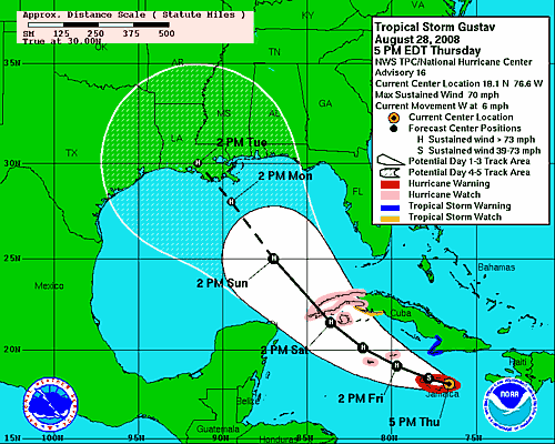
We at UAH are planning another mission…this time to sample the core of the storm, and I’m going. We have a tentative set-up site near Lake Charles, LA, but may have to shift to a site in southern MS or AL if the storm turns north a little quicker.
Then, there’s Tropical Storm Hanna in the Atlantic, which NHC forecasts will turn west early next week. But, there’s a lot of uncertainty with that one, and since it is in the Atlantic, climatology would favor that one not making it to the Gulf. But, this year, let’s not rule anything out.