


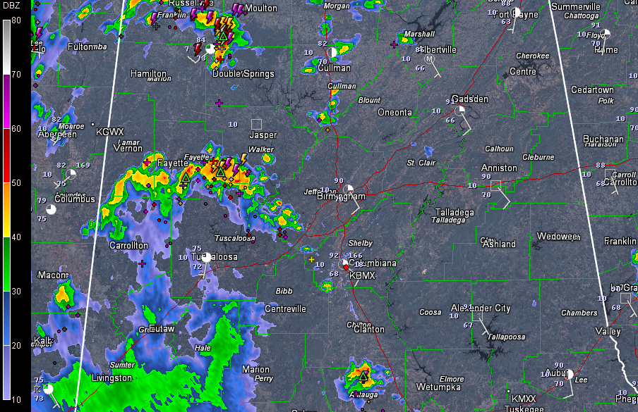
Showers and storms are most prevalent over the western half of the area on this Saturday afternoon, in an area where the deeper moisture resides.
An arc of storms extends from northern Pickens County north of Carrollton into southern Lamar, southern Fayette, southern Walker and extreme southwestern Jefferson Counties. The heaviest cells were near and just southeast of Berry.
Even stronger storms are over northwestern Winston and southwestern Lawrence Counties.
Plenty of lightning, heavy rain and gusty winds with the heavier storms. Dale Robinson, the Skywatcher in southern Lamar County reported a peak wind gust of 53 mph. His temperature dropped to 78F.
The temperature at Tuscaloosa Airport dropped to 79F after a heavy shower. Ron Hughes in nearby Coker reports 76F while Richard Viola in Lake View reports 77F after a brief shower that only dropped 0.05″ on his place.



