


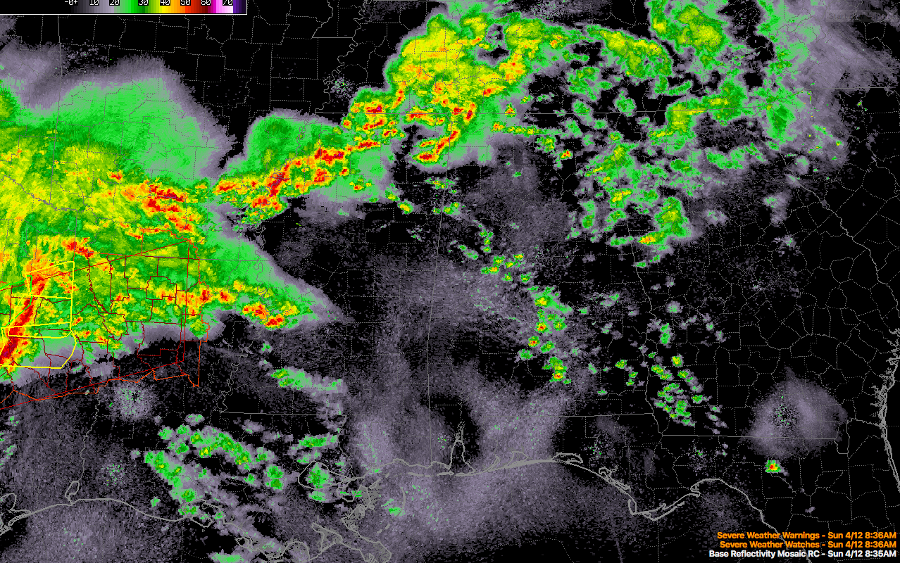
Showers and some thunder continue this morning over Alabama as an upper level disturbance passes to our northwest and a warm front surges northward over Louisiana, Mississippi, and Southwest Alabama. It has now reached Meridian. The warm front has reached I-20 in northern Louisiana, where storms are occurring from Shreveport to Monroe.
An organized mesoscale convective complex is in Northeast Texas near Longview and Marshall. Tornado and severe thunderstorm warnings a re in effect for these storms, which have produce damaging winds across Texas in the Waco and Corsicana areas earlier. These storms will reach Shreveport just after 9:30.
There are some breaks in the clouds over all but Northwest Alabama, allowing for some sunshine. There are some larger breaks over Jefferson and Walker Counties as evidenced on visible satellite pictures. That differential heating could play a role in things later. Temperatures are in the 50s, but will be in the 60s soon in many spots
A few showers and storms will develop along the northward retreating warm front through the late morning and early afternoon. Some of them could be strong to possibly severe with the potential for damaging wind, hail, and tornadoes.
In the warm sector that develops south of the warm front that will encompass much of the state, the airmass will be warm and moist, with temperatures in the 70s and dewpoints in the upper 60s. Instability values will be in the 1,500-2,5000 joules/kg range. The atmosphere may remain capped in many area much of the afternoon into early evening, keeping a lid on thunderstorm development. Increasing winds aloft will lead to increasing shear through the day which will give the storms that can form powerful organization though, and any that do will become severe quickly with large hail, damaging winds, and the potential for strong, long track tornadoes.
Surface low pressure will consolidate over eastern Texas and march toward Little Rock by early evening. This 991 mb low will move toward the Ohio Valley overnight. Meanwhile, the strong upper trough to the west will take on a negative tilt, as it approaches us from the west, triggering large scale lift and helping to break the cap over Alabama. Thunderstorms will develop as it does and these will become severe, producing strong tornadoes, large hail and very high winds. Winds aloft at 5,000 feet will increase rapidly, reaching 80-90 mph over Mississippi and western Alabama by early evening.
A QLCS (Quasi-Linear Convective System) or squall line will push across Alabama during the late evening and early morning hours. These storms will also have potential for tornadoes, hail and high winds, although they should gradually weaken toward midnight. They will exit the East central Alabama around 2 a.m.
Review your severe weather safety plan now. Check out our severe weather safety tips here.



