


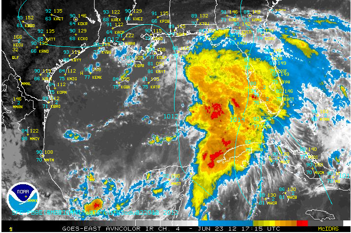
Very shortly, we will have a tropical depression or perhaps even a tropical storm in the Gulf of Mexico. You will probably see advisories issued on the system this afternoon. When the system becomes a storm, it will be named Debby. I think it is the earliest we have ever gotten to the D name in the Atlantic.
The low over the Gulf of Mexico continues to get better organized despite moderate wind shear over the system. Storms are increasing with the system and there have been consistent 30-35 knots winds with the system.
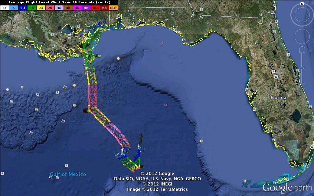
The Air Force plane found a center at 25.9, 87.9, or about 350 miles south of Mobile at 12:16 p.m. North of the center, winds were out of the east northeast. To the south, winds were west southwesterly. So we have a low pressure system, but we knew that already. The lowest pressure was about 1002 millibars.
The wind shear is expected to relax a bit over the next 48 hours, and water temperatures are plenty warm to support the development of the cyclone. The Air Force Hurricane Hunters have tasked another mission into the storm late tonight and multiple missions for tomorrow.
It is expected to move only slowly to the north or north northeast over the weekend. There is general consensus among the models and forecasters up until that point as it moves to a location about 150 miles southeast of New Orleans Sunday. There things diverge. The GFS still carries it slowly east northeast into the Florida Big Bend by Wednesday as a strong tropical storm or minimal hurricane. The ECMWF aka the European still carries it west along the coast to Texas. And the GEM aka Canadian, introduced a new wrinkle as of last night. It carries it into southern Louisiana near Houma as a hurricane on Wednesday and then northward into Mississippi. This could lead to some beneficial rains, which wouldn’t be bad if the winds aren’t bad.
NOTE FROM THE NHC:
TROPICAL STORM WATCHES OR WARNINGS COULD BE REQUIRED FOR A PORTION
OF THE NORTHERN GULF COAST LATER TODAY…AND INTERESTS IN THIS
AREA SHOULD CONTINUE TO MONITOR THE PROGRESS OF THIS LOW. HEAVY
RAINS AND LOCALIZED FLOODING ARE POSSIBLE ACROSS WESTERN CUBA AND
MUCH OF FLORIDA OVER THE NEXT DAY OR SO. TROPICAL-STORM-FORCE
WINDS ARE ALREADY OCCURRING IN THE EASTERN GULF OF MEXICO. PLEASE
SEE MARINE FORECASTS ISSUED BY THE NATIONAL WEATHER SERVICE FOR
ADDITIONAL INFORMATION ON THIS SYSTEM.
MORNING NOTE: The GEM this morning produced a solution that carries the storm up into the northern Gulf Coast, bringing heavy rain up into Mississippi and Alabama. If we could keep it below hurricane strength and just deliver a rain maker, that might overall be a blessing.
IMPACT ON THE GULF COAST: The coast from Dauphin Island to Panama City will experience increasing showers and storms as the low moves northward. Winds will picks up and there will be increasingly rough surf. The threat for undertows will be high as well. All interests along the entire Gulf Coast need to pay close attention to the latest information on soon to be Debby.



