


Three features of interest in the tropical Atlantic make this seem more like September than July.
First, Hurricane Bertha. The longest lived July tropical storm and hurricane is moving rapidly out to the northeast over the Atlantic southeast of Newfoundland. An amazing 67 advisories have been issued on Bertha, which has been a named storm for 16.25 days.
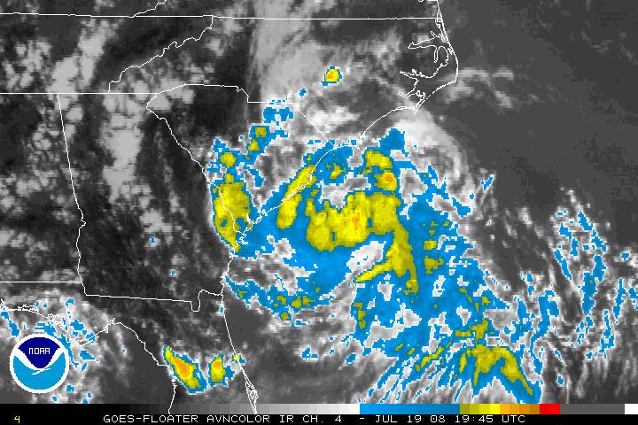
Tropical Storm Cristobal was christened this afternoon off the South Carolina coast. It is not very organized on satellite photos or radar, but it has top winds of 45 mph. It is 75 miles south of WIlmington NC. It is moving northeast at 7 mph. It will pass less than 50 miles off the North Carolina coast at Beaufort and Cape Hatteras. It is expected to continue to strengthen, maxing out at about 60 mph as it passes the Outer Banks and to just below hurricane strength as it exits to the northeast.
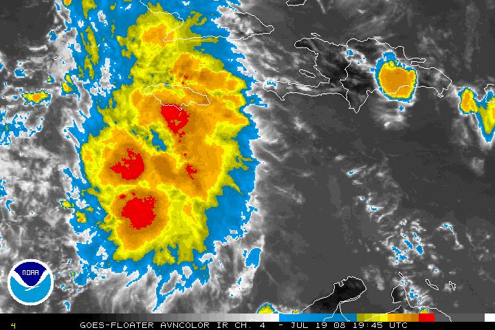
Finally, the disturbance in the Caribbean, entitled 94L by the NHC, has not become a tropical depression yet. Air Force reconnaissance this afternoon has not found a distinct closed circulation or very strong winds. The plane is now back enroute to St. Croix. Thunderstorms continue to increase with this feature about 200 miles south southwest of Jamaica and it is probably only a matter of time until a depression forms.
All of the model guidance is tightly clustered on a solution that carries the prospective depression over the Yucatan and into the southwestern Gulf of Mexico with an eventual landfall in northern Mexico or southern Texas, near Brownsville.
The models indicate that another depression will form in the eastern Atlantic later this week. This potential system is projected by the GFS to move north of the islands next wekeend and make a run at the U.S. East about ten days from now, likely recurving offshore.



