


Click image to enlarge
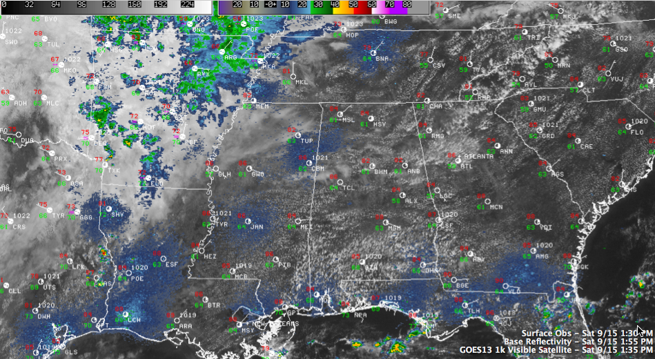
A nice Saturday is in progress across Central Alabama as high pressure tenaciously holds on to control of our weather. Temperatures are climbing through the 80 under partly cloudy skies. It has been was warm as 85F at Birmingham and 86F at Tuscaloosa. Temperatures will edge up a couple of more degrees before they start falling later this afternoon. We should remain dry through late tonight.
Things are about to change however, as some wet weather is on the way.
An upper level disturbance to our west will edge closer to Alabama on Sunday, and the moisture we see to our west will start to edge into the state as well. That will be the recipe for a few scattered showers, perhaps as early as Sunday morning. But the showers and storms will come later Sunday night, as moisture levels start to spike and the upper trough swings our way.
Monday looks like a really wet one, with rainfall amounts averaging one and one half inches. After a cold front passes through on Tuesday, get ready for some fine, fall like weather. Autumn officially begins next Saturday morning, but it will feel like it by Wednesday morning, with average lows near 50F and some scattered 40s. Look for fairly numerous 40s Thursday morning.
FOOTBALL WEATHER
It’s been great weather on the Plains for the Auburn/ULM game today. skies have been partly cloudy with temperatures in the 80s.
Tide/Hogs fans have not enjoyed perfect pre-game weather in Fayetteville, with a few showers around. It was 70F at Fayetteville at 1 p.m. Cloudiness is thick over northwestern Arkansas. There is a persistent southerly breeze. Hopefully the game will be played in dry conditions, but there will probably be a few showers.
UAB travels to Columbia for a big game with South Carolina tonight. Skies will be partly cloudy with a kickoff temperature around 77F, falling into the upper 60s by the fourth quarter. Winds will be light out of the east.



