


The latest convective outlook from the SPC continues to keep most of Alabama in a risk for severe weather. Areas across northwestern portions of the state remained outlined in moderate risk for severe weather. This part of the state will have the most instability and dynamics and will be more likely to see severe weather. This moderate risk area includes areas from Pickens County, towards Fayette then up towards Hunstville.
A slight risk has been issued for almost the rest of the entire state, with the exception being the extreme southeastern counties of the state. The slight risk includes Tuscaloosa, Birmingham, Anniston, Gadsden, Montgomery, Demopolis, Selma and Mobile.
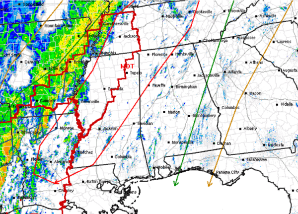
Tornado watches have been issued to our west and heading throughout the rest of the afternoon, we will be watching and waiting for these watches to be extended towards the east as the severe weather threat shifts east.
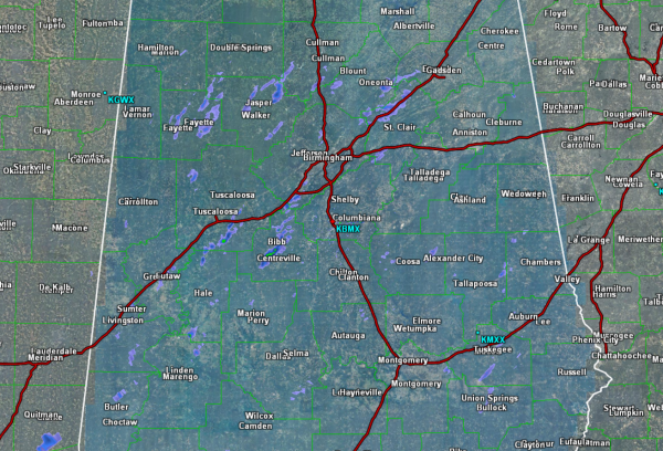
Early this afternoon, the radar across Alabama remains mostly calm, with just a few very light showers racing north with the warm air advection that is ongoing. The main showers and storms remain well to our west across Arkansas, Louisiana, and Texas. As we head into the evening hours, we anticipate the radar to light up like a Christmas tree; first across Mississippi and then into Alabama.
Timing: We still expect the main area of thunderstorms to be approaching our extreme northwestern counties by 8 or 9 PM this evening. There could be a few isolated discrete supercells ahead of the main band and those are certainly the storms we will have to keep an eye on as they are the most likely ones to be rotating.
In addition to the supercells, a very strong line of thunderstorms with damaging winds will be heading across the state during the overnight hours. Within this line of storms, there certainly could be some tornadoes as well.
With the worst of the weather expected overnight for much of Alabama, it is extremely important that you have a way to receive severe weather alerts overnight. Have a weather radio or a smart phone app like MyWARN to keep you notified of the severe weather threat.



