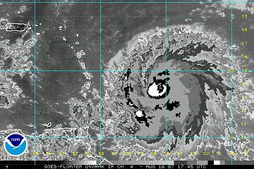
A U.S. Air Force Hurricane Hunter aircraft has been flying around in Hurricane Dean today. Latest message from aircraft indicates maximum flight-level winds around 75 knots (85 mph) in the NW quadrant of the hurricane. They also found an eye structure, open on the west side. One can see the eye in Channel 4 (Dvorak) satellite image below.
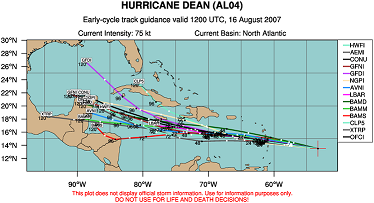
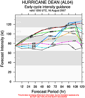
Models are in fairly good agreement, bringing the hurricane through the Caribbean and to the Yucatan by early next week. However, the presence of a weak upper low could change that track, and the GFDL curves the storm more NW into the central Gulf next week. We’ll have to see. With warm water, Dean is forecast to strengthen, with most models bringing it to Category 3 or 4 status by Monday or so. Model track and intensity guidance is attached below. NHC official forecast brings the hurricane to the Yucatan Monday night/early Tuesday with winds of 140 mph. Hurricanes occasionally change track when they go over land (like the Yucatan), and with the GFDL too, this bears watching. The most likely scenario is still a landfall in Mexico or Texas right now.