


The snow is really winding down except for some light and occasionally moderate snow showers near and south of I-59 from Jefferson County up to Gadsden and Centre (yes, I know I-59 doesn’t run through Centre, but it’s “near” for the purpose of this quick discussion). Any additional accumulations of snow more than 1/8″ to 1/4″ are unlikely even in the spots where it is still coming down.
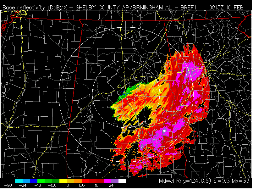
NWS Birmingham Radar in Clear Air Mode
For the rest of the morning, temperatures will be falling into the upper 20s in Birmingham, Tuscaloosa, Anniston, Gadsden and the surrounding areas. It has already plunged to 19º in Haleyville, 25º in Cullman, and 26º at Columbus, Mississippi, so bridges that are wet NOW will likely develop icy patches between now and 6 AM. Travel will actually become more hazardous later on toward sunrise as the ground and especially elevated surfaces have time to freeze.
If you did not measure your snow around I-20 or points south just as the heaviest precipitation ended, you will probably get a lower measurement due to some melting, but there will be some snow left on the ground through the early morning hours. Clouds are already thinning north of Hamilton and Tupelo, so the sun will come out and melt most everything away by early afternoon. Travel conditions may stay pretty rough over northwest Alabama and north Mississippi through midday because it was much colder there all day yesterday and overnight. I would expect some temporary rush hour problems around Birmingham, Tuscaloosa, and Anniston; most of the ice will be gone by 10 AM.
We will have a full rundown on closings, delays, and traffic starting at 4:30 on Good Morning Alabama! Until then, you can get all the latest information we have on those particulars at www.abc3340.com!
SNOW TOTALS! So far, the largest reported accumulations in Alabama are between 4 and 5 inches in a band from Lamar and Pickens Counties through southern Walker, north Tuscaloosa, and western Jefferson, southern Blount and Cullman Counties. Near 4.5″ was reported near the Miller Steam Plant at West Jefferson, and the same was reported at Vernon and Gordo. The highest total around Tuscaloosa is at Lake Tuscaloosa where 4 inches fell, and we have one report from Walker County of 3.5″ near Sumiton as well as 3.25″ in Garden City (Cullman County).
-Jason
Follow me on Twitter: @simpson3340



