


—————————————————————————————-
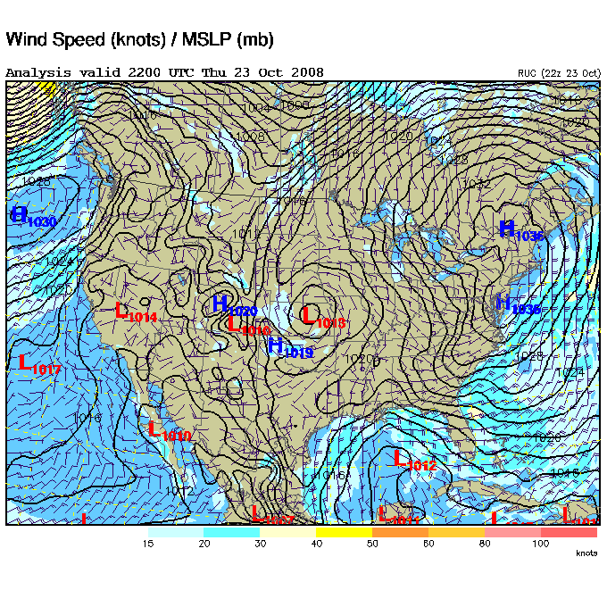
First, take a look at this surface map (above). Note the low pressure area developing over the North Gulf of Mexico. The low over East Kansas is what is left of the winter storm that did not quite live up to its billing.
But notice also the big high pressure area over the NE USA and how it is bulging down the Atlantic Seaboard. Yep, that is the wedge that we have to contend with more often than you think. It is pushing cooler and drier air westward into East Alabama. The dew point has dropped into the 30s over much of Georgia.
Meanwhile, the low in the Gulf is sorta taking over the rain assignment. Heavy rain now near the Alabama-NW Florida coast is partially cutting off the moisture lifeline to North Alabama. At 6 pm, there was moderate to heavy rain over much of South Alabama. Four spot reports:
Montgomery…heavy rain, temperature 59, wind east at 20
Mobile…heavy rain, wind east with gusts to 33
Mt. Cheaha (Skycam)…temperaature 50, wind ESE 28, gusts to 43
Morgantown, W.Va.,…52 clear, wind ESE 12 (will be in the 40s after 7 o’clock)
So, you ask, what does all of this mean? The front to the west (over Mississippi) will slowly move east with its share of the rain. We still expect rain increasing late tonight and continuing most of Friday but diminishing in the afternoon.
MORGANTOWN
Clear weather for the Auburn-West Virginia that starts at 6:30 CDT this evening on ESPN. Temperatures falling into the 40s during the game.



