


Tornado warning for Blount and Etowah Counties…
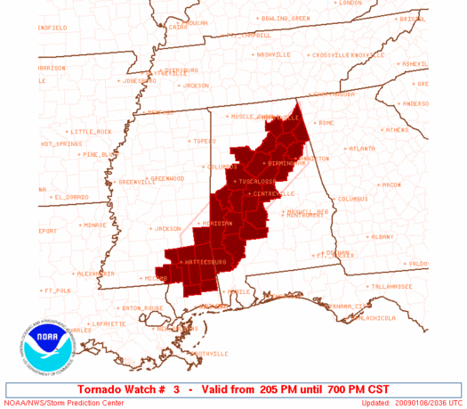
Tornado watch til 7 p.m.
A wide area is under flash flood warning: from northern Pickens, Lamar and Marion Counties…northeast through Lawrence, Winston, Walker, northern Jefferson, Cullman, Blount, Morgan, Limestone, madison, Jackson, DeKalb, Etowah and Cherokee Counties.
A large part of these areas have received over 2.5 inches of rain so far, with many locations picking up over four.
REPORTS
Country road 30 in Blount Co. is washed out…near Susan Moore…until further notice…road completely washed out.
Lamar County…27 roads under water…8 washed out…
Flooding is reported on the WArrior River near Birmingport.
One foot of water reported over US 31 at Bangor in Blount Co.
Flooding reportred 3 miles SW of Sipset…. bingo hall flooded 4ft depth. …highway 78 and Sipsey road. vehicles submerged.
RADAR
The leading edge of our line of storms extends from Collinsville to Altoona to Springville to Tarrant City to Vance to east of Livingston.
Some showers have broken out ahead of the main line over eastern Jefferson County.
The most dangerous segments are from…
…Albertville to Altoona…possible rotation here…dangerous storm there producing tornado warning now…for Blount and Etowah…
…another dangerous segment over western Jefferson County from Adamsville to North Johns.
…In the Vance and Brookwood areas of eastern Tuscaloosa County…
Heavy rain covers a wide area.



