


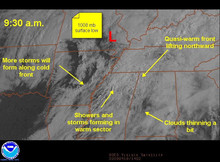
A surface low is located over southern Missouri late this morning. A cold front is back over Arkansas and a pre-frontal trough is approaching the Mississippi River. Ahead of the low, a quasi-warm front is lifting north and northeastward across northern Mississippi into western Alabama. Showers were increasing and a few elevated thunderstorms will accompany this warm front through the morning hours.
Some clearing will occur this afternoon, working on an airmass that has a decent amount of moisture in it, and this will provide the fuel for storms later. Instability levels will be marginal, but there should be enough for some decent updrafts. Wind speed will increase with height, providing about 25 knots of effective wind shear. Not off the scale, but enough for organized storms to form. Hail will be a definite possibility.
Low level spin in the atmosphere will be best along the warm front over Northwest Alabama early, and if any storms get organized there, they could produce a brief tornado. Surface winds are expected to become more southerly and southwesterly with time, reducing the tornado threat, but again, an isolated one can’t be ruled out. A squall line is forming ahead of the cold front and it will push through the state between 3-9 p.m. Damaging, winds and an isolated tornado will accompany the storms in the line.
So again, it is a marginal event, but one that definitely will still have to be monitored through the day and into the overnight. Keep close to a reliable source of weather information, like your weatheradio, and keep an eye to the sky. Review you personal severe weather plan and be ready to act when warnings are issued.



