


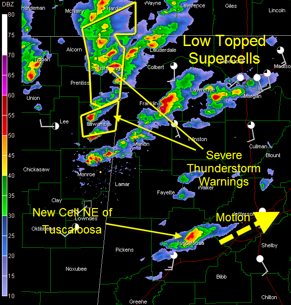
Low topped supercells continue across the northwestern quarter of Alabama this afternoon.
It’s hard to call them thunderstorms, since they aren’t producing very much in the way of lightning. A little was showing up in Franklin County.
Probably the most suspicious looking storm in Alabama is crossing SR-24 east of Russellville. It definitely shows some spin.
A strong storm is approaching Red Bay in western Franklin County. It shows potential for large hail.
Another intensifying storm was north of Bexar in western Marion County. It will move toward Hodges in Winston County.
In the Birmingham metro, strengthening storms extend from north of Tuscaloosa to west of Hueytown. The letter storm did have a nice rain free base and pseudo wall cloud as it passed north of Northport.
There is not much instability but a good deal of spin in the atmosphere, so the storms do ave organized updrafts. They are capable of damaging winds and even isolated small tornadoes. With cold air aloft, they could produce large hail as well.
Golf ball sized hail was reported near Tupelo.
No warnings in Alabama right now, but you can expect some soon.
A severe thunderstorm watch remains in effect until 7 p.m. for several counties across the Central and North Alabama.



