


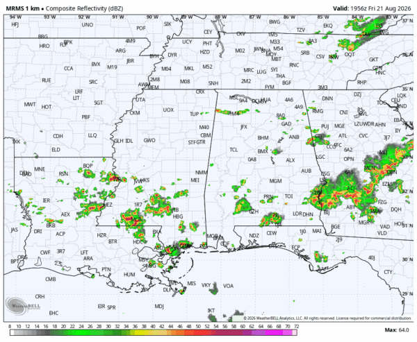
RADAR CHECK: As expected, scattered showers and thunderstorms are more numerous over the southern half of Alabama this afternoon… they are more isolated over the northern counties. Heavier storms are producing strong wind gusts, torrential rain, and lots of lightning. Away from the storms temperatures are mostly in the low 90s.
We note a severe thunderstorm watch is in effect for Southwest Alabama until 8p CT.
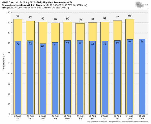
THE WEEKEND: While you always have the risk of a pop up shower or storm on a summer day in Alabama, they should be fewer in number tomorrow and Sunday. Odds of any on spot getting wet both days are down in the 15-25 percent range, with afternoon highs in the low 90s for most communities.
NEXT WEEK: Showers/storms remain very isolated Monday and Tuesday with relatively dry air in place, but global models suggest we will see an increase in rain coverage over the latter half of the week. Highs will be in the 87-93 degree range… See the video briefing for maps, graphics, and more details.
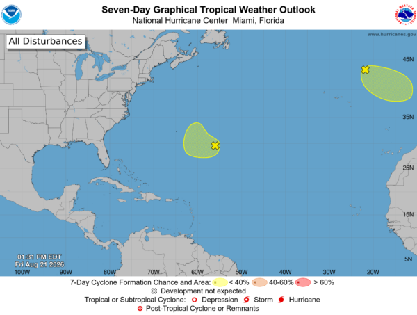
TROPICS: NHC is monitoring two areas of interest in the central and eastern Atlantic, but they have only a low chance of development and are not close to the U.S. The rest of the Atlantic basin remains quiet over the weekend. A tropical wave will move off the coast of Africa next week, but it by chance anything develops it will likely turn north well before getting close to the U.S.
ON THIS DATE IN 1942: The 1942 Texas hurricane made landfall on the upper Texas coast near Crystal Beach/Bolivar Peninsula, east of Galveston. NOAA’s reanalysis lists it as a Category 1 hurricane with 75 mph winds.
Look for my next video briefing here by 6:00 a.m. Monday… enjoy the weekend!



