


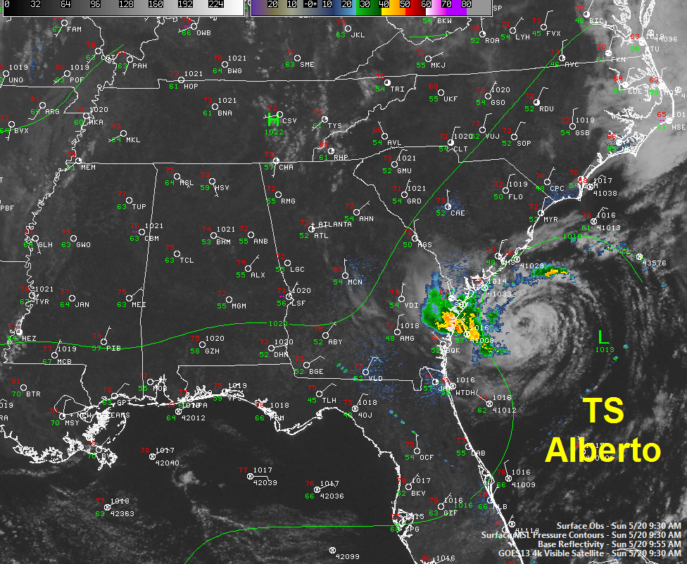
Tropical Storm Alberto is a little weaker this morning, with top winds of 45 mph. The radar signature has weakened as the system is ingesting dry air from the Southeast.
It is also undergoing increasing shear and it is moving over cooler water.
In fact, Alberto may even be weaker than the intensity carried in this advisory.
Air Force reconnaissance is scheduled to investigate the tropical cuclone this afternoon.
The storm is moving slowly west southwest, but it is expected to become nearly stationary this afternoon in anticipation of a movement to the northeast tomorrow.
It will pass just east of Cape Hatteras Tuesday morning and become extratropical as it moves northeast over the open Atlantic.
GEORGIA/SOUTH CAROLINA REPORTS
The first numbers are temperature/dew point
…Savannah: 63/50…light rain…N 13 G 18
…St. Simons: 69/49…cloudy…NW 8 G 18
…N Charleston: 70/48…partly sunny…N 16 G 23
…Beaufort AP: 70/50…partly sunny…N 17 G 28
…N Myrtle Beach: 73/50…sunny…NE 16
Notice the low dew points (around 50F). That’s the drier air that is being ingested by Alberto.
Buoy 41004…41 miles SE of Charleston SC…NW wind 31 mph gusting to 39 mph


