


A second severe thunderstorm warning has been added, just to the south of the original one since the severe storms over Pike County just east of Troy seem to be turning to the right.
This storm has increasing signs of organization as well and will have to be watched for tornado potential.
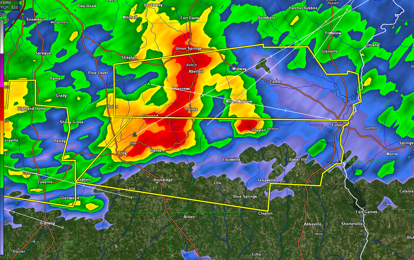
The National Weather Service in Birmingham has issued a
* Severe Thunderstorm Warning for…
Central Pike County in southeastern Alabama…
South central Bullock County in southeastern Alabama…
Southern Barbour County in southeastern Alabama…
* Until 730 AM CST.
* At 652 AM CST, a severe thunderstorm was located over Banks, or 8
miles north of Brundidge, moving east at 40 mph.
HAZARD…60 mph wind gusts.
SOURCE…Radar indicated.
IMPACT…Expect damage to roofs, siding, and trees.
* Locations impacted include…
Troy, Eufaula, Brundidge, Clio, Goshen, Clayton, Louisville, Banks,
Tyler Crossroads, Blue Springs State Park, Linwood, Osco, Richards
Crossroads, White Oak, Boot Hill, Gaino, Antioch, Texasville, Troy
University and Millers Ford.



