


Light rain and drizzle are still coming down over a large part of Central and East Alabama, but temperatures are only cold enough for additional freezing rain near and north of a line from Meridian, Mississippi to Birmingham to Gadsden. That is not to exclude some isolated areas where temperatures may briefly dip to 31 as heavier precipitation moves in; it is just a general guideline. Slightly-higher dewpoint air (dewpoints over 33 degrees) is blowing west out of Georgia into eastern Alabama; since the temperature cannot go below the dewpoint, expect it to just be a cold rain for the rest of the day where this is happening. North and west of there, the lines are fuzzy for a reason! Some communities will be below freezing all morning, some will fluctuate between 31 and 33, and others will stay near 33 all day. There is no way to resolve that kind of situation on a point-by-point basis, so here is a general idea of what you can expect. The farther east of I-65 you are, the less likely it is that additional significant icing will occur. Over northwest Alabama and eastern Mississippi, the next round of heavier precipitation will keep the temperature at or below freezing, so another 1/10″ to 1/4″ of ice accumulation is possible.
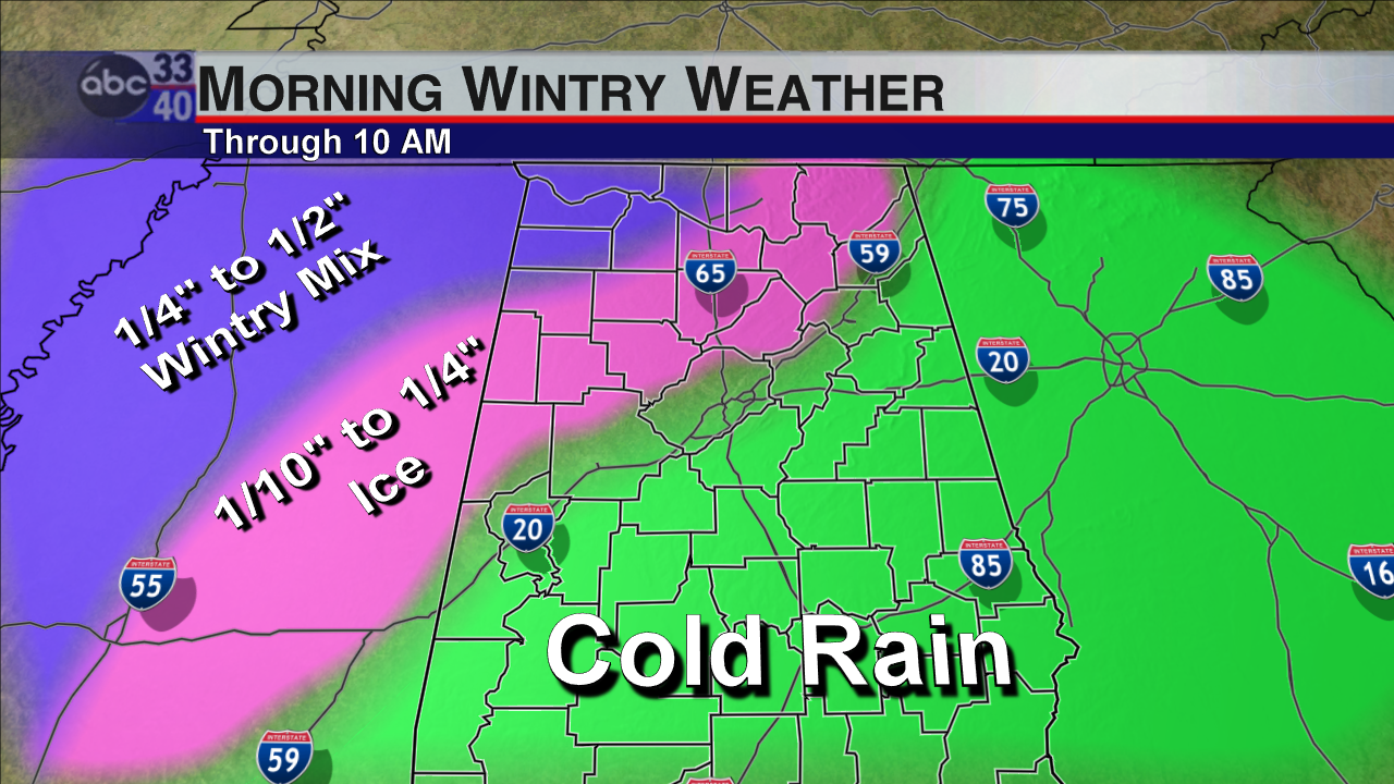
Approximate Precipitation Type & Accumulation. Some Adjustments May Be Needed.
This round of precipitation, by the way, is the one we actually expected. The wintry weather that moved in on Thursday was fast and unexpected; this round should be easier to handle and easier for us to make adjustments as needed.
A Winter Weather Advisory and a Winter Storm Warning remain in effect for parts of Alabama and Mississippi. Be careful on the roads this morning!
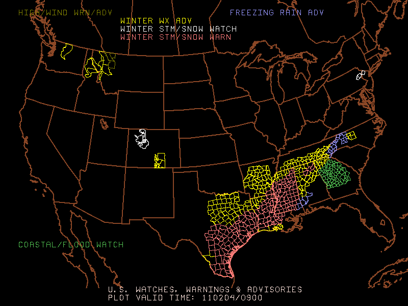
3 AM Watches & Warnings
-Jason
Follow me on Twitter: @simpson3340



