Scroll down for thoughts from Dr. Tim, the afternoon Weather Xtreme video and blog discussion, and other good tidbits.
The highlights of our thinking…
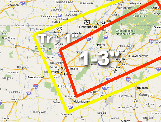
*The best chance of accumulating snow should be over the eastern side of the state, especially East-Central and Northeast Alabama.
*Dynamic cooling from a very cold upper trough will have to come into play for heavier snow and the needed low level cold air.
*Most of the accumulating snow will be on the grass; we figure most roads will be only wet as temperatures remain above freezing tomorrow. Major travel issues are not expected, however some black ice is possible tomorrow night.
*There will be surprises with this system; we really won’t won’t know where the heavier snow bands, possibly convective in nature, will set up until early tomorrow morning.
The general idea of what we expect is below; the better chance of the 3 inch amounts will be across high terrain of east Alabama, especially above 1,200 feet.