


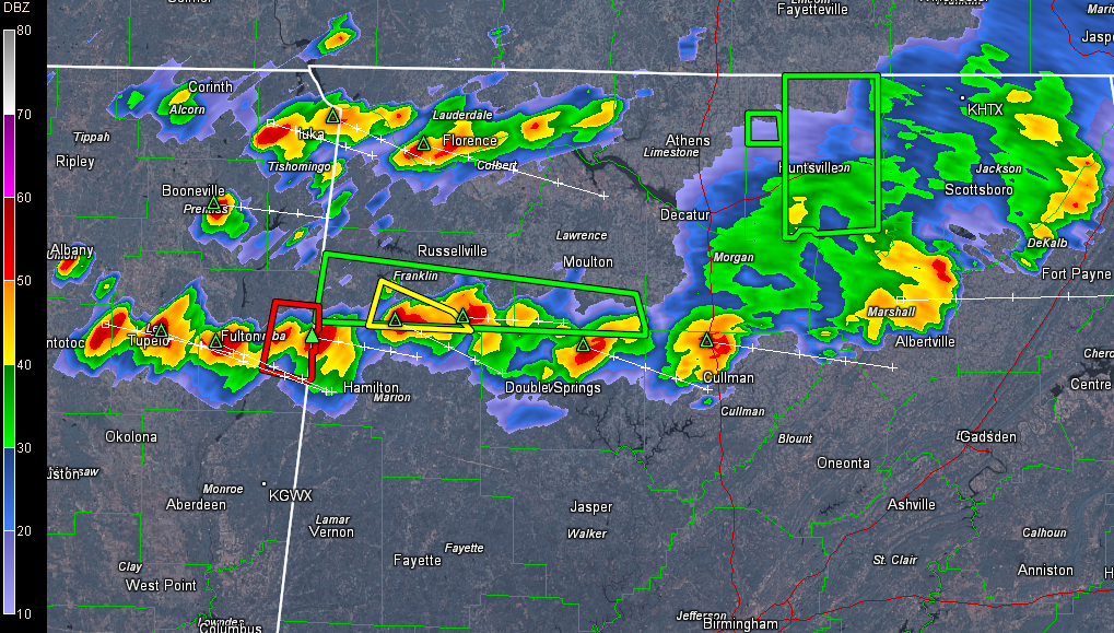
Our line of storms is slowly sagging southeastward tonight.
It extends from eastern Jackson County east of Scottsboro to northern Marshall County north of Albertville to northern Cullman County north of Cullman, into northern Winston County northeast of Double Springs then through extreme northern Marion and southern Franklin Counties into Mississippi near Tupelo.
There are flash flood and severe thunderstorm warnings as well, all issued by the NWS Huntsville.
Severe Thunderstorm Watch continues for Blount, Calhoun, Cherokee, Cleburne, Etowah, Jefferson, St. Clair [AL] till 11:00 PM CDT and a Tornado Watch continues for Fayette, Lamar, Marion, Walker, Winston [AL] till 11:00 PM CDT also.



