


Brian will be along with a full discussion and Weather Xtreme video shortly. A few notes…
*The latest model runs are actually in pretty decent agreement… potential for a 1 to 2 inch snow late tonight for Birmingham, with potential heavier amounts over Northeast Alabama. Not so sure Tuscaloosa sees that much… one way or another I would not consider this event a “major” one, but it could be enough to disrupt travel tomorrow morning. See the GFS snow output below:
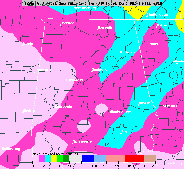
*I must note the RPM is not as bullish on snow, with only very light amounts around here. But, it did not perform very well with Friday’s event until about 6 hours before it started.
*TIMING: Some scattered light rain is possible during the daytime hours, mainly north of U.S. 278 (Hamilton to Cullman to Gadsden). The light rain will be more widespread across North Alabama early tonight, then changing to snow in the 11:00 p.m. to 2:00 a.m. time frame. Looks like a fairly quick snow, with most of it being out of here by 8:00 a.m. tomorrow.
*THUNDER? We do note the very steep lapse rates, which always brings up the idea of some thunder with the snow late tonight or during the pre-dawn hours tomorrow. I would say possible, but not likely.
Brian will have the video and complete details shortly. Stay tuned…



