


Not much change in our overall thinking for today… here is the Maxwell AFB radar…
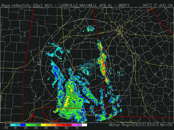
We will have to watch that band that is setting up along the Alabama/Georgia border for any sign of small, spin-up tornadoes, but we have no severe weather in progress now, and no major problems are expected today. We do note that the NWS has issued a flash flood warning for Lee and Russell counties in that nearly stationary band within the last few minutes.
The rain shield with tropical depression Claudette will move up into the northern half of the state this afternoon and tonight, with rain amounts of 1/2 to 1 inch expected. Winds will remain in the 10 to 20 mph range, and the risk of a small tornado remains low, and no tornado watch is anticipated at this time. Instability values are very low, and wind fields with Claudette are weak.
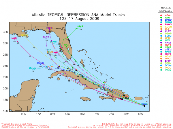
OTHER TROPICAL NOTES: See the morning Weather Xtreme video for all of the details… Ana is falling apart now, and should be downgraded to a tropical wave later this morning. Here is a quick peek at the new 12Z model tracks for Ana, assuming it remains an identifiable system (which remains to be seen):
Hurricane Bill will grow stronger, but will remain at sea as he recurves east of the U.S. mainland. Our friends on the island of Bermuda will have to watch this one closely, however….



