


We have been watching a cluster of storms that formed over southeastern Kansas this morning. It is now over southeastern Missouri and northeastern Arkansas. It has become more organized and stronger as it pushes east-southeastward, prompting numerous severe thunderstorm warnings.
This graphic packs a lot of information:
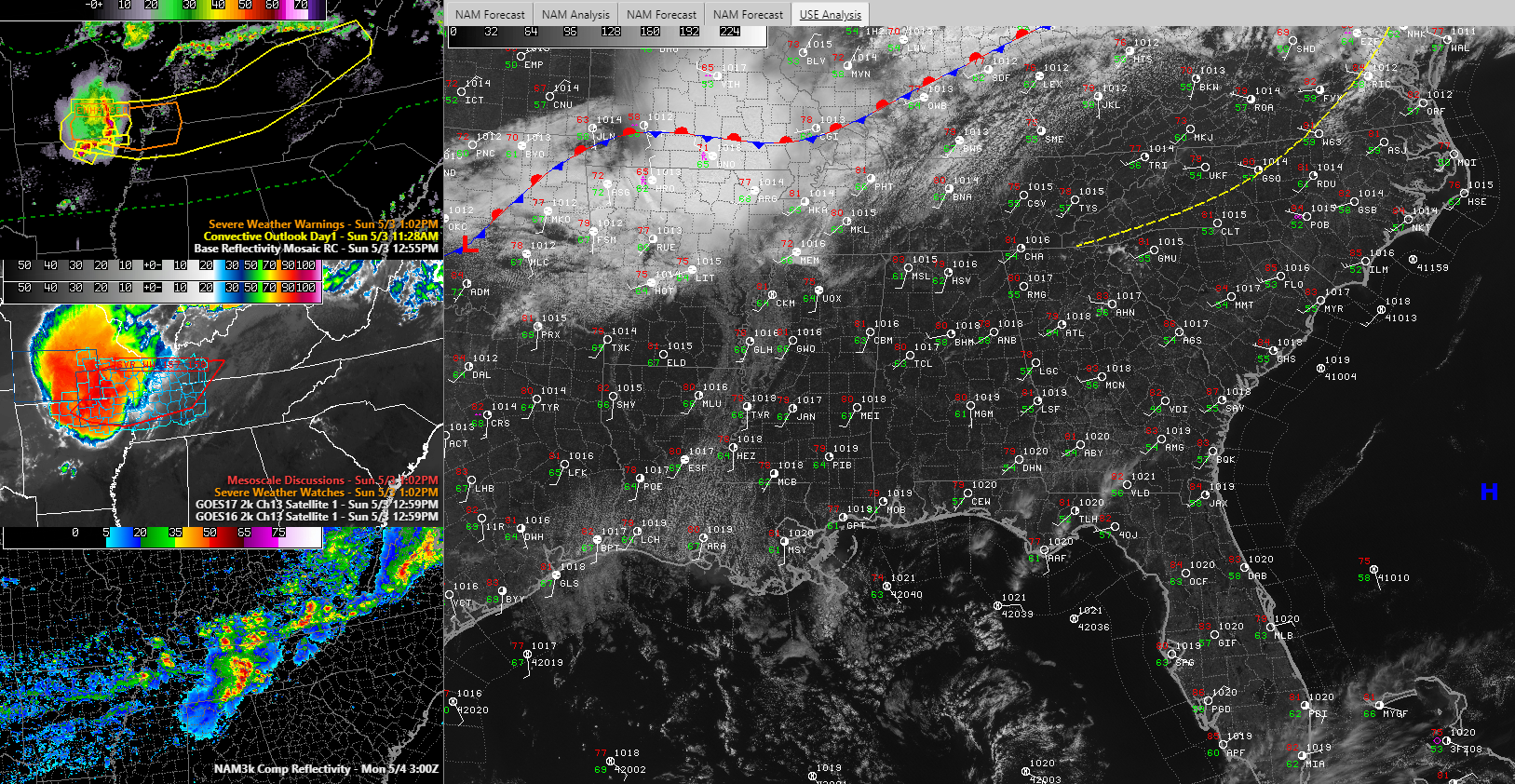
The top left panel shows the radar, current warnings, and the SPC Outlook. Ahead of the complex, there is an enhanced risk (2/5) into western Kentucky and Tennessee. A severe thunderstorm watch has been posted for western Tennesee, western Kentucky, extreme southern Illinois, southeast Missouri, and northeast Arkansas.
The middle left panel shows the watch and the enhanced IR satellite showing the coldest cloud tops and strongest storms.
The bottom left panel depicts the 3km NAM depiction of where the storms might be about 10 p.m. tonight. They would be grazing the Alabama/Tennessee border, so we can’t rule out them getting into our northern counties.
In addition, a few rogue showers/storms could form over southern Tennessee and move into Northwest Alabama this evening. We will be watching for that possibility.
In the large panel, you can see skies are mostly sunny across Alabama. Winds are out of the southwest and temperatures are in the 80s, with the exception of Anniston that was 78F when this snapshot was taken. Dewpoints are in the lower 60s, starting to get a little uncomfortable
More storms may form on Monday and a couple of them could be strong if they get going. Additional storms will form on Tuesday as the front sinks into Alabama. They could also be strong. Cooler weather will arrive Wednesday with rain expected again Friday into early Saturday. The weekend looks very cool, with lows in the 40s and highs Saturday not getting out of the 60s.



