


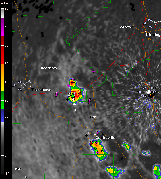
Showers and storms are forming over the southern half of Alabama on this Sunday afternoon.
The one furthest north was just south of I-59 between Brookwood and Vance at 2 p.m. This storm was small but it had grown to a height of over 50,000 feet. It is pushing south. It contains heavy rain and lightning. Derek in Coaling reports nearly constant thunder.
Temperatures were climbing through the 90s over the area. Tuscaloosa was already up to 95F.
Very hot temperatures will be the norm over the next few days as drier air infiltrates the state. By Tuesday, we will see dewpoints in the lower 60s and perhaps even 50s! Much less humid! Unfortunately, it won’t be cooler in the daytime, although overnight lows may dip into the 50s. Afternoon readings in the upper 90s will be common the next couple of days.



