


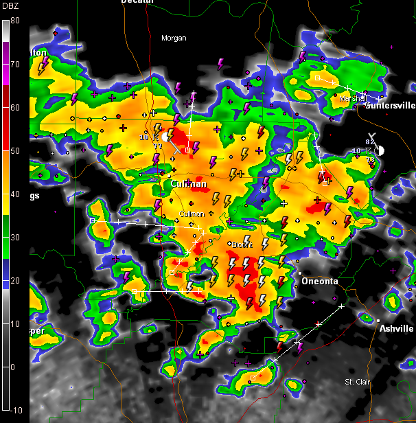
LATE NOTE: Flash flood warning has been issued for much of Cullman County until 12:45 a.m…rainfall estimates of over 3 inches have fallen to the east of Hanceville and in the Fairview/Baileyton area.
ANOTHER LATE NOTE: Flash flood warning has been issued for Blount County until 1145 pm.. Some four inch rainfall estimates north of Nectar.
A large complex of thunderstorms continues tonight over North Central Alabama. They cover much of Cullman and Blount Counties at this hour.
Tops on the storm have been measured at over 55,000 feet. The storm towers have been very visible from great distances, illuminated internally by lightning.
The most intense rainfall right now is east of Cullman and west of Oneonta.
Doppler radar rainfall estimates show over two inches of rain in just an hour over Blount County and southeastern Cullman County…between Hanceville and Garden City…and west of Nectar. Localized flash flooding could occur.
Tremendous lightning with the storms…



