


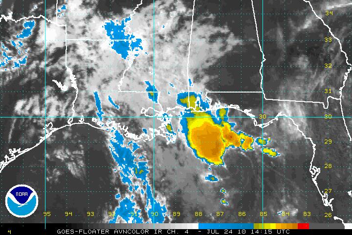
The center of Tropical Depression Bonnie is now about 140 miles south of Navarre Beach, Florida. Movement is WNW at 17. Will pass just east of the mouth of the Mississippi early this evening and make landfall in St. Bernard Parish just southeast of New Orleans about 10-11 p.m.
It is not expected to regain tropical storm strength.
Radars show scattered thunderstorms over southeastern Louisiana at this hour. Showers and storms are rather numerous in the offshore waters off the Mississippi, Alabama and Northwest Florida coasts. They will begin affecting the Alabama coast this afternoon.
Showers and storms are becoming fairly numerous over the southern half of Mississippi. They just get into parts of extreme northwestern Sumter County in West Alabama.
Hopefully Bonnie will bring some additional moisture into Alabama tomorrow to temperature the extreme heat we are experiencing. Be careful if you will be out working or playing today, as temperatures will be over 100F again in many locations and heat index values will be in the dangerous category.
An isolated storm is possible today across the I-20 corridor, with little chance north of there, and slightly better chances further south over South Central and West Central Alabama.
Highs will be in the middle and upper 90s for the next several days, with perhaps some relief by late next week into the weekend.
Here is the top box of the 10 a.m. CDT advisory…
343
WTNT33 KNHC 241434
TCPAT3
BULLETIN
TROPICAL DEPRESSION BONNIE ADVISORY NUMBER 9
NWS TPC/NATIONAL HURRICANE CENTER MIAMI FL AL032010
1000 AM CDT SAT JUL 24 2010
…BONNIE HANGING IN THERE WITH 30 MPH WINDS…TROPICAL STORM
WARNINGS DISCONTINUED…
SUMMARY OF 1000 AM CDT…1500 UTC…INFORMATION
———————————————–
LOCATION…28.0N 86.7W
ABOUT 165 MI…265 KM ESE OF THE MOUTH OF THE MISSISSIPPI RIVER
ABOUT 155 MI…250 KM SW OF APALACHICOLA FLORIDA
MAXIMUM SUSTAINED WINDS…30 MPH…45 KM/HR
PRESENT MOVEMENT…WNW OR 300 DEGREES AT 17 MPH…28 KM/HR
MINIMUM CENTRAL PRESSURE…1014 MB…29.94 INCHES



