


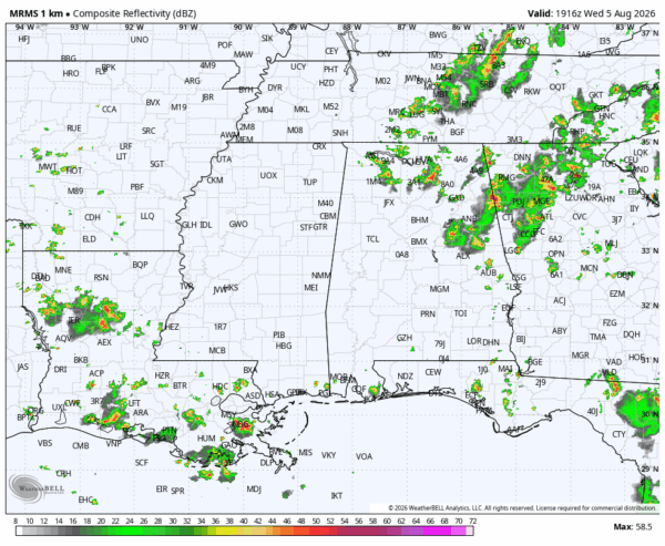
RADAR CHECK: Scattered showers and thunderstorms are most numerous over the northern and eastern counties of Alabama this afternoon… a few spots have received over one inch of rain. But, for much of the state, the sky is partly sunny with temperatures at or just over 90 degrees. Scattered storms end tonight after sunset.
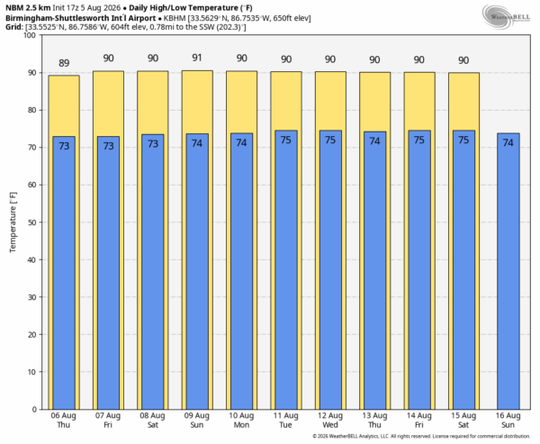
Alabama’s weather won’t change much tomorrow and Friday. Partly sunny days along with a few isolated showers/storms around during the afternoon and evening hours. The chance of any one spot seeing some rain is 20-30 percent, and most of them will come from around 12 noon until 9:00 p.m. Afternoon highs will be in the 89-93 degree range, right at seasonal averages.
A disturbance has potential to bring a slightly higher coverage of scattered showers/storms to the northern half of Alabama Saturday, otherwise the weather stays the same over the weekend. Highs in the low 90s, mixed sun and clouds, and “scattered, mostly afternoon and evening showers and thunderstorms”. Just what we expect around here in August.
NEXT WEEK: The classic summer pattern stays in place. An upper ridge overhead (not especially strong), and the main mid-latitude westerlies (the jet stream) well to the north. Highs in the low 90s, a few isolated afternoon showers or thunderstorms daily. See the video briefing for maps, graphics, and more details.
TROPICS: All remains calm across the Atlantic basin, and tropical storm formation is not expected for at least the next 7-10 days.
ON THIS DATE IN 2024: Hurricane Debby: Debby made landfall near Steinhatchee, Florida, in the Big Bend at about 7a ET as a Category 1 hurricane, with 80 mph winds. Heavy rainfall was exacerbated by Debby’s slow motion, with accumulations peaking near 20 inches near Sarasota.
Look for the next video briefing here by 6:00 a.m. tomorrow…



