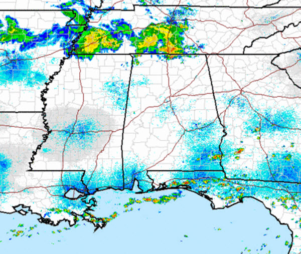
Over the last few hours, clouds have been increasing across sections of Central Alabama. These clouds are being blown off from the tops of thunderstorms that are over the Tennessee Valley. These thunderstorms were associated with severe weather over Missouri and Arkansas yesterday and last night. The clouds making it into our part of the state are upper-level clouds and are not associated with storms in our area. The main affects from these clouds are they are filtering the afternoon sun and could actually keep our afternoon highs from going much higher, especially over the northern half of the state. Southern sections of the state are seeing more sun, and therefore are hotter.

A look at the radar shows that showers and storms are making their way into North Alabama, but over the last few hours, these storms have weakened compared to what they were overnight. This trend looks to continue for the next few hours and we are not expecting this activity to impact portions of Central Alabama. We will watch for outflow boundaries that this activity could send out in their wake. Outflow boundaries are notorious for providing enough uplift to allow for thunderstorm development. That is likely to occur this afternoon and isolated showers and storms could develop in our part of the state. Storms are not likely to reach severe limits, but they could certainly produce torrential rain and dangerous lightning.