


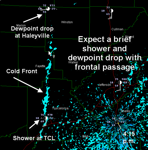
Here comes the front finally.
Still not much development over North Alabama. A shower over southeastern Lawrence County might be the first cell. There is a good CU field in front of the front on visible satellite.
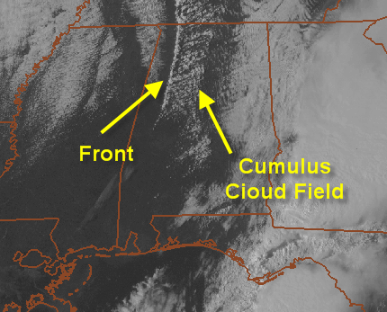
Even though there is a good bit of CAPE (1000-1500 j/kg) just east of I-65, the shear is pretty strong also and it might take updrafts a little time to establish themselves.
The front will help to spark a few cells over the Northeast part of Alabama. A tornado watch is in effect until 9 p.m. for counties in the Huntsville NWS area of responsibility, including Cullman, Marshall and DeKalb.



