


Daily Weather Briefing
January 17, 2026
ALABAMA YESTERDAY
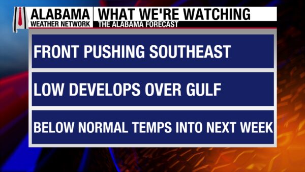
Yesterday was a clear and mild day, with highs reaching the upper 50s in east and central Alabama, to the low 60s in the west. A few clouds rolled into north Alabama in the afternoon. Wind gusts ranged in the 20s throughout the day and were more frequent in the northern and southern parts of the state. Showers associated with a cold front began in the northwest around 6 P.M. yesterday and have made their way through the state overnight.
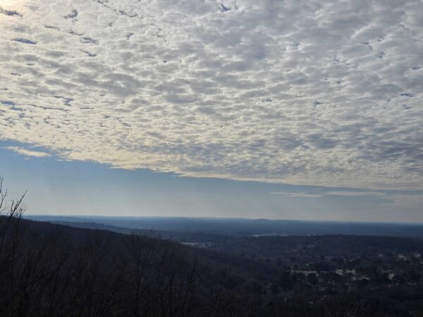
Skywatcher Sandra Kirkwood sent in this photo from atop Huntsville Mountain at Blevins Gap Nature Preserve yesterday.
ALABAMA THIS MORNING
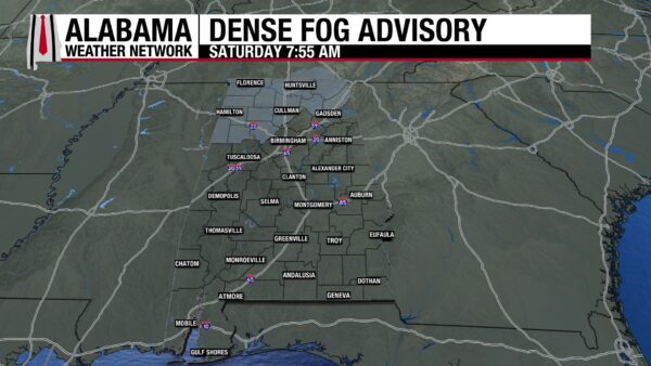
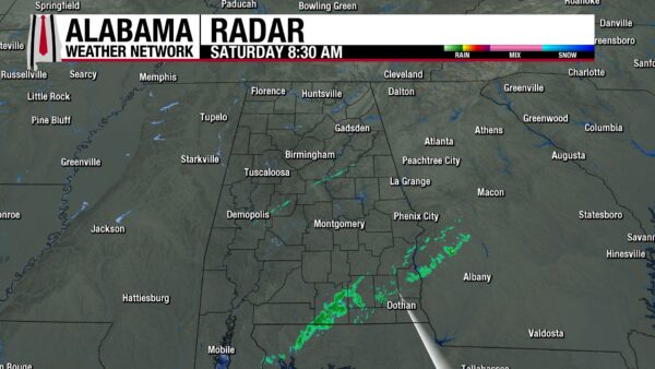
The showers now sit near south of Troy and will continue southeastward through the morning. Temperatures range from the upper 30s north to the low 40s to low 50s in central and south Alabama. Moisture left behind from the front has led to some fog formation in north Alabama. A Dense Fog Advisory will be in effect until 9 A.M.
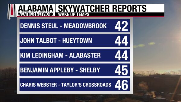
The Skywatchers report temperatures in the 40s to start the long weekend.
ALABAMA 7 DAY FORECAST
Cooler temperatures and cloudier skies are the story today. Tonight, a cold front will bring more rain, then the chance for snow Sunday morning to south Alabama. Sunday will be cold and dry in the afternoon. The state will continue to be cold and dry through Wednesday. An approaching low-pressure system will uptick rain chances Wednesday night through Thursday, then dry conditions return Friday.
DRY NORTH, SHOWERY SOUTH TODAY
The state has two distinct forecasts today.
In the north and the western portion of north-central Alabama, conditions will stay dry and cloudy, and temperatures will be in the upper 40s and low 50s.
In the south and the eastern portion of south-central Alabama, the showers will clear out of the southeast this morning, before more filter into the state through the southwest corner in the late morning/early afternoon. They will travel northeastward during the day. Temperatures will sit in the mid 50s.
All areas of the state will see an increase in strength of wind gusts in the evening hours, blowing in the 20s.
RAIN TONIGHT, SNOW IN MORNING?
The north will see little change to its weather pattern overnight, as clouds stick around and precipitation chances stay zero. Lows will fall to the upper 20s.
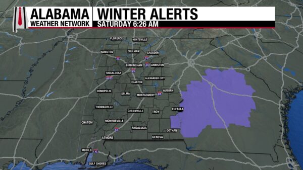
Rain will continue in the south through the night, with a chance to change to snow in the mid-morning hours (6-9 A.M.). There is still a chance that no snow could fall, but it stays in the forecast as a low possibility. Snow accumulation will be very light, less than one inch, and will stick more easily in grassier areas. Henry County is the only county in Alabama under a Winter Weather Advisory, meaning light snow and accumulations up to one inch are expected. It will be in effect from Sunday morning at 3 A.M. until 11 A.M.
CHILLY SUNDAY
Regardless of snow, the state will be chilly Sunday. High temperatures will be in the upper 30s to low 40s in north and central Alabama, and in the mid 40s south. If snow accumulates, the temperatures in the 40s and sunny skies will facilitate melting by the afternoon.
SLIGHT WARMING MONDAY
Dry conditions persist Monday, with highs rising slightly into the low 40s north to the low 50s south. This is an almost unnoticeable warm-up for the state.
LITTLE COOL DOWN TUESDAY
A weak and dry cold front will move through Alabama on Tuesday, bringing no significant impacts except for slightly cooler temperatures. Highs will reach the upper 30s north and the upper 40s to low 50s south.
WARMING UP AGAIN WEDNESDAY
Skies will still be mostly clear on Wednesday, with highs ranging from the upper 40s to the low 50s from north to central Alabama, and from the mid-50s to the low 60s in the south. Cloud cover may increase into the late afternoon/evening hours. Rain chances increase into the night as well
RAIN CHANCE THURSDAY
The rain chance sticks around throughout Thursday, and highs reach the mid 40s north and mid 50s south.
DRY AGAIN FRIDAY
After the low-pressure system moves away from the area, conditions will clear up again Friday. Highs will range from the low 50s to the low 60s.
RECORD-LOW TEMPERATURES SET IN SOUTHEAST
While many record high temperatures are being broken toward the west, record low temperatures were surpassed or tied in Florida and Georgia yesterday. The bullets read: Location, new record, old record (date set).
- Melbourne International Airport, FL, 33, 34 (1983)
- Fort Pierce, FL, 32, tied (1978)
- Craig Municipal Airport, FL, 25, tied (1978)
- Jacksonville, FL, 22, tied (1927)
- Apalachicola, FL, 25, 27 (1972)
- Alma, GA, 17, 21 (1948)
DROUGHT CONDITIONS IMPROVED
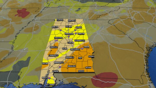
After last weekend’s soaking rains, Alabama’s drought conditions have improved significantly. No part of the state is under Extreme Drought (D3) anymore. The Severe Drought category has increased by less than 4% to 25.29% due to the improvement of the D3 category. 41.66% of the state is in Moderate Drought (D1), a 26% decrease from last week. 33.05% of Alabama is experiencing Abnormally Dry (D0) conditions, a 26% increase, due to the improvement in the D1 category. Unfortunately, there is still no part of the state that is drought-free.
SNOW SQUALLS IN MIDWEST
Snow squalls behind an Arctic cold front continue in the Midwest today. Snow squalls change conditions rapidly by reducing visibility and creating dangerous travel conditions.
GUSTY CONDITIONS CONTINUE OVER PLAINS
Gusty winds will continue in the Plains today due to a strong surface low.
ABOVE AVERAGE TEMPERATURES IN WEST
Record-breaking warmth continues in the west because of strong upper-level ridging.
NATIONAL HIGH AND LOW
Indio, California, hit the national high of 87 degrees yesterday. Mount Washington, New Hampshire, fell to the national low of –16 degrees.
SHOWERS EXPECTED TODAY
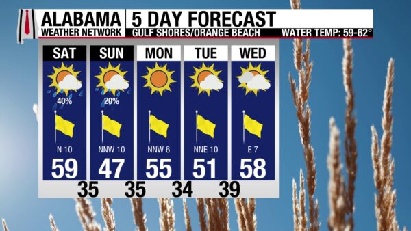
Today will be mostly cloudy with a chance of showers along the coast. Highs will in the upper 50s, and winds will be around 15 mph. The risk for rip currents is low and surf height is around two to three feet. A chilly few days are ahead.
TODAY IN WEATHER HISTORY
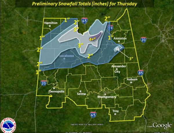
January 17, 2013 – The Alabama Snowstorm of 2013
On January 17, 2013, a powerful upper-level low-pressure system brought snow to North and Central Alabama. A unique atmospheric setup allowed moisture to be “thrown” into the upper-level low. This, combined with strong dynamic cooling that made the upper air very cold, and strong mesoscale forcing, permitted snow to fall to the ground and stick despite 40+ degree ground temperatures. This setup created instability, and several lightning strikes were seen. Thunder was heard from Cullman County, into Walker, and to Jefferson and St. Clair counties. Most areas received 1 to 3 inches of snow, with Birmingham recording 2.1”. Locally higher amounts fell, 6” of snow fell at Straight Mountain in Blount County. The Cullman Civic Center was opened to give shelter to stranded motorists along I-65 between Cullman and Falkville. Conditions cleared quickly, and areas along and west of I-65 had clear skies before sunset.
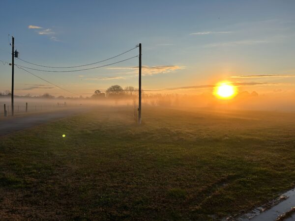
IMAGE OF THE DAY
Skywatcher Terry Bishop sent in this enchanting photo of the foggy sunrise in Snead, Alabama, this morning.



