


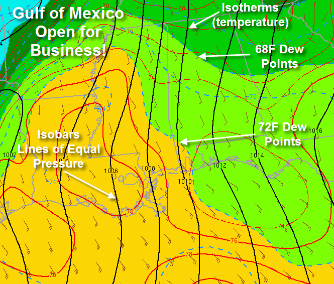
The Gulf of Mexico is wide open for business, pumping tremendous amounts of moisture and warm air northward.
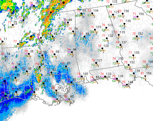
Look at the warm temperatures, high dewpoints, and “backed” surface winds in the danger areas over Mississippi. “Backed” means coming from the southeast rather than the south, as in backing up the hands of a clock. This “backing” gives extra spin to the atmosphere.
Instability values are rising, especially to the west of Alabama. When CAPE values start reaching 1000 j/kg, thunderstorms start really going. They thrive on CAPES of 2000 j/kg.
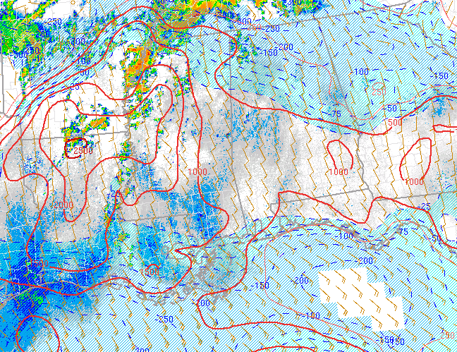
The light blue shading on the CAPE map is CIN, or convective inhibition. That is a little bit of a cap in the atmosphere where temperatures rise with height, putting a lid on thunderstorm development. As temperatures warm into the lower 80s, that cap will erode. You can see that it is already eroded over the southwestern 2/3rds of Alabama and Mississippi back into Louisiana and Arkansas. Look at those CAPEs over northern Louisiana, running 2,500 j/kg. Storms that develop back in that environment will quickly become severe.
The Significant Tornado composite index is now 2-3 over a wide areas of Mississippi. SigTor values over 1 are associated with F2 and greater tornadoes. Remember last week, it was maxing out at 7.8 over Mississippi.
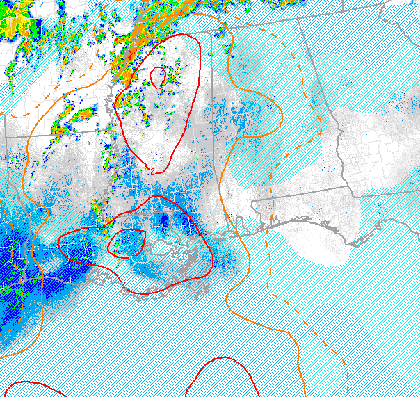
Bottom line is that a dangerous situation is setting up over Arkansas, Tennessee, Mississippi and SE Missouri where a high risk severe weather outlook is in effect for today. These storms will advance towards Alabama later. In addition, as the sun comes out, our atmosphere will become more unstable and storms will for over Alabama as well. As we head into the nighttime hours, an increasing low level flow will further enhance the threat of tornadoes.



